Category:Oude Liermolen
Jump to navigation
Jump to search
| Object location | | View all coordinates using: OpenStreetMap |
|---|
windmill in De Lier, Netherlands  | |||||
| Upload media | |||||
| Instance of |
| ||||
|---|---|---|---|---|---|
| Location | De Lier, De Lier | ||||
| Street address |
| ||||
| Has use |
| ||||
| Heritage designation |
| ||||
| Source of energy | |||||
 | |||||
|
This is a category about rijksmonument number 527574
|
| Address |
|
Media in category "Oude Liermolen"
The following 6 files are in this category, out of 6 total.
-
 De Lier - Oude Liermolen - gedenksteen.jpg 1,500 × 1,480; 2.07 MB
-
 Gemaal Oude Lierpolder.jpg 4,608 × 3,456; 7.04 MB
-
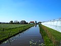
 Oude Liermolen en water.JPG 4,000 × 3,000; 2.2 MB
-
 Oude Liermolen, De Lier.JPG 3,000 × 4,000; 2.72 MB
-
 Voormalige molen van de oude Lierpolder, stichtingssteen - De Lier - 20139941 - RCE.jpg 1,200 × 1,193; 418 KB
-


