Category:Oude Doornse molen
Jump to navigation
Jump to search
| Object location | | View all coordinates using: OpenStreetMap |
|---|
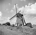
windmill in Almkerk, Netherlands  | |||||
| Upload media | |||||
| Instance of |
| ||||
|---|---|---|---|---|---|
| Location | Almkerk, Altena, North Brabant, Netherlands | ||||
| Street address |
| ||||
| Has use |
| ||||
| Heritage designation |
| ||||
| Source of energy | |||||
 | |||||
|
This is a category about rijksmonument number 39608
|
| Address |
|
Media in category "Oude Doornse molen"
The following 37 files are in this category, out of 37 total.
-
 Aanzicht - Almkerk - 20007346 - RCE.jpg 1,200 × 1,091; 184 KB
-
 Aanzicht - Almkerk - 20007347 - RCE.jpg 1,200 × 1,188; 324 KB
-
 Aanzicht - Almkerk - 20007354 - RCE.jpg 1,200 × 1,174; 241 KB
-
 Aanzicht - Almkerk - 20007357 - RCE.jpg 1,200 × 1,176; 258 KB
-
 Aanzicht - Almkerk - 20007359 - RCE.jpg 1,186 × 1,200; 259 KB
-
 Aanzicht - Almkerk - 20007360 - RCE.jpg 1,181 × 1,200; 216 KB
-
 Aanzicht detail - Almkerk - 20007361 - RCE.jpg 1,186 × 1,200; 344 KB
-
 Aanzicht exterieur - Almkerk - 20007358 - RCE.jpg 1,200 × 1,181; 178 KB
-
 Aanzicht exterieur, na herstel - Almkerk - 20007351 - RCE.jpg 1,200 × 1,172; 255 KB
-
 Achtkante poldermolen in bedrijf - Almkerk - 20007451 - RCE.jpg 1,200 × 1,195; 223 KB
-
 Achtkante poldermolen met molenaar bij de staart - Almkerk - 20007452 - RCE.jpg 1,191 × 1,200; 310 KB
-
 Almkerk, bij de molen de Oude Doorn.jpg 5,232 × 3,184; 4.7 MB
-
 Bovenlicht met levensboom - Almkerk - 20007447 - RCE.jpg 1,200 × 784; 160 KB
-
 De Oude Doorse molen uit 1700 te Almkerk.jpg 4,820 × 3,227; 4.77 MB
-

-
 Exterieur - Almkerk - 20007344 - RCE.jpg 769 × 1,200; 162 KB
-
 Exterieur - Almkerk - 20007345 - RCE.jpg 770 × 1,200; 151 KB
-
 In vreugdestand - Almkerk - 20007363 - RCE.jpg 1,200 × 1,175; 247 KB
-
 In vreugdestand - Almkerk - 20007364 - RCE.jpg 1,200 × 1,181; 257 KB
-

-

-

-
 Oude Doornse molen.jpg 2,592 × 1,944; 1.91 MB
-
 Plaatsing "Bosmanmolen", aanzicht - Almkerk - 20007355 - RCE.jpg 1,200 × 1,179; 277 KB
-
 Plaatsing "Bosmanmolen", aanzicht - Almkerk - 20007356 - RCE.jpg 1,200 × 1,181; 301 KB
-
 Slecht muurwerk schepradzijde - Almkerk - 20007349 - RCE.jpg 1,200 × 1,171; 351 KB
-
 Tekst en uitleg bij de Oude Doornse molen.jpg 3,170 × 2,677; 4.66 MB
-
 Toegang stookhok - Almkerk - 20007350 - RCE.jpg 1,200 × 1,167; 202 KB
-
 Vanaf Verlaatsedijk - Almkerk - 20007353 - RCE.jpg 1,200 × 1,174; 271 KB
-
 Vanuit het zuiden - Almkerk - 20007352 - RCE.jpg 1,200 × 1,181; 289 KB
-
 Vernield rieten dak - Almkerk - 20007431 - RCE.jpg 1,200 × 1,184; 305 KB
-
 Vernieuwing rietdek - Almkerk - 20007348 - RCE.jpg 1,200 × 1,160; 246 KB
-
 Wapensteen tegen bakstenen muur - Almkerk - 20007446 - RCE.jpg 795 × 1,200; 181 KB
-
 Watermolen "De Ouden Doorn, in bedrijf - Almkerk - 20007369 - RCE.jpg 1,200 × 1,186; 245 KB
-
 Watermolen "De Ouden Doorn, kruihaspel - Almkerk - 20007370 - RCE.jpg 1,200 × 1,191; 373 KB
-
 Watermolen De Ouden Doorn aanzicht - Almkerk - 20007367 - RCE.jpg 1,200 × 1,186; 250 KB
-
 Watermolen De Ouden Doorn, aanzicht - Almkerk - 20007368 - RCE.jpg 1,200 × 1,176; 270 KB


