Category:Otterburn, North Yorkshire
Jump to navigation
Jump to search
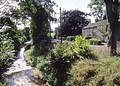
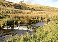
village and civil parish in the Craven district of North Yorkshire, England, UK  Otterburn Beck, north of Otterburn. | |||||
| Upload media | |||||
| Instance of | |||||
|---|---|---|---|---|---|
| Location | Craven, North Yorkshire, Yorkshire and the Humber, England | ||||
| Population |
| ||||
 | |||||
English: Otterburn is a village and civil parish in the Craven district of North Yorkshire, England. It is at OS Grid Reference SD8857, near Airton, Calton and the A65.
Media in category "Otterburn, North Yorkshire"
The following 99 files are in this category, out of 99 total.
-
 'Common Nook', NE of Otterburn - geograph.org.uk - 4667733.jpg 1,024 × 683; 200 KB
-
 Approaching Kendal House - geograph.org.uk - 6756696.jpg 1,600 × 1,133; 429 KB
-
 Benchmark on Crane Field Laithe - geograph.org.uk - 4669563.jpg 683 × 1,024; 320 KB
-
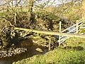
 Benchmark on Otterburn Bridge - geograph.org.uk - 4669579.jpg 1,024 × 683; 355 KB
-
 Bridge below Reek House Hill - geograph.org.uk - 6284985.jpg 1,024 × 768; 238 KB
-
 Bridge over Otterburn Beck - geograph.org.uk - 2060582.jpg 640 × 480; 139 KB
-
 Bridge over Otterburn Beck - geograph.org.uk - 5854939.jpg 1,600 × 1,067; 621 KB
-
 Country Lane Otterburn - geograph.org.uk - 1893392.jpg 4,224 × 3,168; 6.32 MB
-
 Crake Moor Covert - geograph.org.uk - 1214038.jpg 640 × 480; 131 KB
-
 Crane Field Beck and Laithe - geograph.org.uk - 5810347.jpg 1,024 × 768; 68 KB
-
 Crane Field Beck passing through sheep pasture - geograph.org.uk - 3944115.jpg 1,024 × 768; 104 KB
-
 Crane Field Hill - geograph.org.uk - 5091461.jpg 5,184 × 3,193; 1.79 MB
-
 Crane Field Laithe - geograph.org.uk - 3944111.jpg 1,024 × 768; 79 KB
-
 Crane Field Laithe - geograph.org.uk - 4669571.jpg 1,024 × 683; 147 KB
-
 Crane Field Laithe - geograph.org.uk - 5092042.jpg 4,972 × 3,042; 1.6 MB
-
 Dacre Lane - geograph.org.uk - 1214149.jpg 640 × 480; 139 KB
-
 Dacre Lane - geograph.org.uk - 1214157.jpg 640 × 480; 156 KB
-
 Dacre Lane - geograph.org.uk - 2837518.jpg 3,072 × 2,304; 1.54 MB
-
 Dacre Lane, Otterburn - geograph.org.uk - 2838217.jpg 3,072 × 2,304; 1.62 MB
-

-
 Dowber Syke - geograph.org.uk - 5092043.jpg 3,456 × 3,335; 2 MB
-
 Entrance road to Hurries Farm - geograph.org.uk - 6196752.jpg 1,024 × 683; 152 KB
-
 Entrance to Hurries Farm - geograph.org.uk - 5854932.jpg 1,600 × 1,067; 449 KB
-

-
 Farmland, South Field Hill - geograph.org.uk - 4659440.jpg 640 × 426; 62 KB
-
 Field boundary - geograph.org.uk - 4659447.jpg 640 × 426; 39 KB
-
 Field off the Bell Busk road - geograph.org.uk - 619038.jpg 640 × 458; 65 KB
-
 Ford, Otterburn - geograph.org.uk - 619085.jpg 640 × 480; 118 KB
-
 Gate near Hurries Farm - geograph.org.uk - 5855516.jpg 1,600 × 1,067; 634 KB
-
 Gateways near Hurries Farm - geograph.org.uk - 4668731.jpg 1,024 × 683; 234 KB
-
 Gnarled hawthorn near Otterburn Beck - geograph.org.uk - 5854944.jpg 1,600 × 983; 481 KB
-
 Hawthorn trunks and roots, Otterburn - geograph.org.uk - 619101.jpg 640 × 480; 168 KB
-
 Hillside grazing, Reek House Hill - geograph.org.uk - 3806448.jpg 640 × 469; 52 KB
-
 Hurries Farm - geograph.org.uk - 1893379.jpg 4,224 × 3,168; 5.99 MB
-
 Hurries Farm - geograph.org.uk - 2838218.jpg 3,072 × 2,304; 1.09 MB
-
 Hurries Farm - geograph.org.uk - 5092044.jpg 5,184 × 2,678; 1.81 MB
-
 Hurries Farm - geograph.org.uk - 5217914.jpg 1,600 × 1,200; 756 KB
-
 Langber Lane - geograph.org.uk - 965966.jpg 640 × 416; 99 KB
-

-
 Log piles in Weningber Plantation - geograph.org.uk - 4667738.jpg 1,024 × 683; 230 KB
-
 Near the Otterburn Beck - geograph.org.uk - 6756657.jpg 1,600 × 1,009; 669 KB
-
 Old seat with lamp post and pump. - geograph.org.uk - 379568.jpg 640 × 480; 166 KB
-
 Otterburn - geograph.org.uk - 5092052.jpg 5,184 × 2,941; 1.77 MB
-
 Otterburn - geograph.org.uk - 966536.jpg 640 × 480; 96 KB
-
 Otterburn and the Otterburn Beck - geograph.org.uk - 965979.jpg 640 × 459; 164 KB
-
 Otterburn Beck - geograph.org.uk - 2060581.jpg 640 × 480; 131 KB
-
 Otterburn Beck - geograph.org.uk - 2060583.jpg 640 × 480; 143 KB
-
 Otterburn Beck - geograph.org.uk - 543213.jpg 640 × 480; 223 KB
-
 Otterburn Beck - geograph.org.uk - 5854941.jpg 1,600 × 1,067; 361 KB
-
 Otterburn Beck - geograph.org.uk - 5855509.jpg 1,600 × 1,067; 415 KB
-
 Otterburn Beck - geograph.org.uk - 6756695.jpg 1,600 × 1,096; 865 KB
-
 Otterburn Beck, east of Reek House Hill - geograph.org.uk - 3944137.jpg 1,024 × 768; 131 KB
-
 Otterburn Beck, south of the village - geograph.org.uk - 6284959.jpg 1,024 × 768; 276 KB
-
 Otterburn Beck.jpg 640 × 480; 70 KB
-
 Otterburn Bridge - geograph.org.uk - 1213991.jpg 480 × 640; 129 KB
-
 Otterburn Bridge - geograph.org.uk - 4669585.jpg 1,024 × 683; 159 KB
-
 Pasture land, Bonber Hill - geograph.org.uk - 4659436.jpg 640 × 426; 47 KB
-
 Phragmites in Otterburn Beck - geograph.org.uk - 5855503.jpg 1,600 × 1,067; 558 KB
-
 Pole and rock strata, Otterburn - geograph.org.uk - 619110.jpg 640 × 480; 147 KB
-
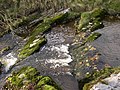 Rapids, Otterburn - geograph.org.uk - 619150.jpg 640 × 480; 145 KB
-
 River bed, Otterburn - geograph.org.uk - 619115.jpg 640 × 480; 175 KB
-
 Road closed at Otterburn cross roads - geograph.org.uk - 4669593.jpg 1,024 × 683; 171 KB
-
 Sheep and lambs alongside Crane Field Beck - geograph.org.uk - 3944091.jpg 1,024 × 768; 115 KB
-
 Sheep and lambs alongside Crane Field Beck - geograph.org.uk - 3944119.jpg 1,024 × 768; 123 KB
-

-
 Sheep grazing near Otterburn - geograph.org.uk - 6284971.jpg 1,024 × 768; 89 KB
-
 Sheep grazing, Crane Field Hill - geograph.org.uk - 4659449.jpg 640 × 426; 54 KB
-
 Sheep grazing, east side of Reek House Hill - geograph.org.uk - 3944131.jpg 1,024 × 614; 105 KB
-
 Sheep grazing, South Field Hill - geograph.org.uk - 4659445.jpg 640 × 426; 47 KB
-
 Sheepfold , Otterburn - geograph.org.uk - 618767.jpg 640 × 474; 125 KB
-
 Slopes of Crane Field Hill - geograph.org.uk - 4659452.jpg 640 × 426; 47 KB
-
 South Field Hill - geograph.org.uk - 4659443.jpg 640 × 426; 73 KB
-
 Stone barn at Hurries Farm - geograph.org.uk - 5854935.jpg 1,600 × 1,067; 579 KB
-
 The bridge at Otterburn - geograph.org.uk - 618734.jpg 640 × 495; 121 KB
-
 The eastern approach to a ford, Otterburn - geograph.org.uk - 618739.jpg 640 × 480; 171 KB
-
 The end of a ridge, Otterburn - geograph.org.uk - 618755.jpg 640 × 526; 120 KB
-
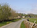
 The lane to Long Preston, Otterburn - geograph.org.uk - 618744.jpg 640 × 390; 121 KB
-
 The track to Kendal House, east of Otterburn - geograph.org.uk - 3944124.jpg 1,024 × 768; 102 KB
-
 The western approach to a ford, Otterburn - geograph.org.uk - 618735.jpg 640 × 480; 152 KB
-
 Track alongside the Otterburn Beck - geograph.org.uk - 965974.jpg 640 × 412; 97 KB
-
 Track and ash tree, Otterburn - geograph.org.uk - 619094.jpg 640 × 441; 73 KB
-
 Track from Park House - geograph.org.uk - 966533.jpg 640 × 480; 113 KB
-
 Track from Park House, Otterburn - geograph.org.uk - 619153.jpg 640 × 480; 140 KB
-
 Track north of Otterburn - geograph.org.uk - 4442410.jpg 2,592 × 1,944; 1.69 MB
-
 Track to Park House, Otterburn - geograph.org.uk - 619067.jpg 640 × 480; 89 KB
-
 Track to Park House, Otterburn - geograph.org.uk - 619124.jpg 640 × 472; 92 KB
-
 Track to Park House, Otterburn - geograph.org.uk - 619131.jpg 640 × 471; 94 KB
-
 Track to Park House, Otterburn - geograph.org.uk - 619156.jpg 640 × 470; 97 KB
-
 Track, Otterburn - geograph.org.uk - 619060.jpg 640 × 469; 108 KB
-
 Tree roots near Park House, Otterburn - geograph.org.uk - 619167.jpg 640 × 492; 146 KB
-
 Trees, Otterburn - geograph.org.uk - 619042.jpg 640 × 480; 99 KB
-
 Triple culvert - geograph.org.uk - 6285005.jpg 1,024 × 768; 162 KB
-
 View towards Crane Field Hill - geograph.org.uk - 4659451.jpg 640 × 426; 53 KB
-
 View towards Kendal Hill - geograph.org.uk - 6285012.jpg 1,024 × 768; 107 KB
-
 View towards Otterburn on a fine spring day - geograph.org.uk - 6284952.jpg 1,024 × 768; 195 KB
-
 Waterfall, Otterburn - geograph.org.uk - 619074.jpg 640 × 470; 116 KB
-
 Waterlogged grazing - geograph.org.uk - 3803444.jpg 640 × 480; 40 KB
-
 Wenningber Hill - geograph.org.uk - 966551.jpg 640 × 480; 59 KB
-
 Which way to go^ - geograph.org.uk - 1213995.jpg 640 × 480; 100 KB


