Category:Osage maps
Jump to navigation
Jump to search
Media in category "Osage maps"
The following 13 files are in this category, out of 13 total.
-
 Map of Kansas and Nebraska. LOC 98688397.jpg 8,719 × 6,964; 8.28 MB
-
 Map of Osage Indian Reservation - NARA - 84786048.jpg 17,584 × 13,293; 12.33 MB
-
 Map of Osage Indian Reservation - NARA - 84786050.jpg 17,659 × 13,499; 10.96 MB
-
 Map of Osage Indian Reservation - NARA - 84786052.jpg 17,970 × 13,482; 12.31 MB
-
 Map of Osage Indian Reservation - NARA - 84786054.jpg 18,112 × 14,085; 13.44 MB
-
 Map of Osage Indian Reservation - NARA - 84786056.jpg 18,208 × 14,041; 12.74 MB
-
 Map of Osage Indian Reservation - NARA - 84786058.jpg 17,717 × 13,454; 12.36 MB
-
 Map of Traditional Osage Tribal Lands by Late 17th Century.jpg 400 × 400; 43 KB
-
 Oklahoma Tribal Statistical Area.svg 828 × 400; 1.49 MB
-
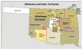 Okterritory.png 2,515 × 1,500; 534 KB
-
 Omaha migration after Dorsey.png 1,934 × 2,386; 5.19 MB
-
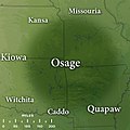
 Osage map.svg 512 × 324; 28 KB
-
 Wichita native areas and some archaeological sites in Kansas, Oklahoma and Texas.png 1,295 × 1,399; 126 KB


