Category:Ortspyramide Wittgensdorf
Jump to navigation
Jump to search
| Object location | | View all coordinates using: OpenStreetMap |
|---|
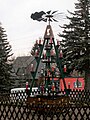
Deutsch: Die Ortspyramide Wittgensdorf befindet sich an der Kreuzung Burgstädter Straße / Genossenschaftsstraße in Chemnitz-Wittgensdorf
Media in category "Ortspyramide Wittgensdorf"
The following 9 files are in this category, out of 9 total.
-
 Ortspyramide Wittgensdorf (1).jpg 3,327 × 2,496; 1.36 MB
-
 Ortspyramide Wittgensdorf (2).jpg 2,670 × 3,559; 1.8 MB
-
 Ortspyramide Wittgensdorf (3).jpg 3,000 × 4,000; 1.91 MB
-
 Ortspyramide Wittgensdorf im Dunklen (1).jpg 3,000 × 4,000; 3.38 MB
-
 Ortspyramide Wittgensdorf im Dunklen (2).jpg 3,000 × 4,000; 3.3 MB
-
 Ortspyramide Wittgensdorf im Dunklen (3).jpg 3,000 × 4,000; 3.25 MB
-
 Ortspyramide Wittgensdorf, mittlere Etage.jpg 4,000 × 3,000; 3.25 MB
-
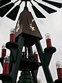 Ortspyramide Wittgensdorf, obere Etage.jpg 3,000 × 4,000; 3.24 MB
-
 Ortspyramide Wittgensdorf, untere Etage.jpg 4,000 × 3,000; 3.72 MB
.jpg)
.jpg)
.jpg)
.jpg)
.jpg)
.jpg)


