Category:Ortskapelle (Nachbarheid)
Jump to navigation
Jump to search
| Object location | | View all coordinates using: OpenStreetMap |
|---|
| Upload media | |||||
| Instance of | |||||
|---|---|---|---|---|---|
| Location | Nachbarheid, Gangelt, Heinsberg, Cologne Government Region, North Rhine-Westphalia, Germany | ||||
| Heritage designation | |||||
 | |||||
Media in category "Ortskapelle (Nachbarheid)"
The following 5 files are in this category, out of 5 total.
-
 Kapelle in Nachbarheid.jpg 1,600 × 2,400; 369 KB
-
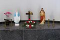 Nachbarheid Kapelle Altar.jpg 1,200 × 800; 90 KB
-
 Nachbarheid Kapelle Ansicht.jpg 400 × 600; 47 KB
-
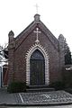
 Nachbarheid Kapelle Aussenansicht.jpg 800 × 1,200; 131 KB
-
 Nachbarheid Kapelle Innenansicht.jpg 1,200 × 800; 85 KB


