Category:Orographic maps
Jump to navigation
Jump to search
Media in category "Orographic maps"
The following 23 files are in this category, out of 23 total.
-
1916 map by the British Admiralty War Staff - ARABIA - Orographical Features.jpg 11,043 × 9,072; 13.17 MB
-
Bathy-orographical map of the world.jpg 2,428 × 1,606; 1.23 MB
-
GangesValley&Plain.jpg 2,165 × 1,512; 680 KB
-
India orographic map - Longmans 1924.jpg 1,216 × 1,527; 362 KB
-
India Orographical Features Plate 4, Imperial Gazetteer of India, Atlas, 1909.jpg 3,065 × 2,532; 2.17 MB
-
Map of Eastern Siberia.png 1,541 × 982; 2.74 MB
-
Mapa hipsométrico de Braga.jpg 4,677 × 3,307; 1.48 MB
-
Mozambique Topography.png 1,578 × 2,274; 3.07 MB
-
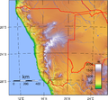
Namibia Topography.png 2,094 × 1,934; 2.88 MB
-
Nepal topo.jpg 1,400 × 852; 362 KB
-
Orographical basin of the St Lawrence basin - by J. G. Bartholomew - btv1b530606061.jpg 9,253 × 5,464; 9.1 MB
-
Orographical Map of the british islands - by Willia Shawe - btv1b53029506h.jpg 6,807 × 8,600; 9.01 MB
-
Orographical map of the Dardanelles reduced from captured Turkish maps.jpg 10,507 × 15,328; 27.23 MB
-
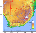
South Africa Topography.png 1,578 × 1,457; 2.38 MB
-
The Victoria History of the County of Buckinghamshire - Orographical Map Part 1.jpg 2,597 × 1,592; 892 KB
-
The Victoria History of the County of Buckinghamshire - Orographical Map Part 2.jpg 2,597 × 1,728; 1.01 MB


