Category:Orogeny
Appearance
- (en) Orogeny
- (ast) Oroxénesis
- (bn) গিরিজনি
- (ca) Orogènesi
- (cs) Orogeneze
- (de) Gebirgsbildung
- (es) Orogénesis
- (et) Orogenees
- (fi) Orogenia
- (fr) Orogenèse
- (he) אורוגנזה
- (hr) Orogen
- (hu) Hegységképződés
- (it) Orogenesi
- (ja) 造山運動
- (kk) Орогенез
- (ko) 조산 운동
- (lt) Kalnodara
- (nl) Gebergtevorming
- (nn) Orogenese
- (no) Fjellkjedefolding
- (pl) Orogeneza
- (pt) Orogênese
- (ro) Orogeneză
- (ru) Горообразование
- (sh) Orogeneza
- (sk) Orogenéza
- (sl) Orogeneza
- (sr) Орогенеза
- (sv) Orogenes
- (uk) Орогенез
- (vi) Kiến tạo sơn
formation of mountain ranges at convergent plate boundaries | |||||
| Upload media | |||||
| Instance of | |||||
|---|---|---|---|---|---|
| Subclass of |
| ||||
| Different from | |||||
| |||||
Subcategories
This category has the following 50 subcategories, out of 50 total.
!
- Nevadan Orogeny (7 F)
*
- Orogenic cycle (5 F)
A
- Alice Springs Orogeny (2 F)
C
- Cadomian orogeny (1 F)
- Capricorn Orogen (2 F)
- Cimmerian Orogeny (empty)
E
- Eburnean Orogeny (1 F)
F
- Famatinian orogeny (empty)
G
- Gothian Orogeny (empty)
H
- Halls Creek Orogeny (1 F)
- Hooper Orogeny (9 F)
I
- Innuitian Orogeny (empty)
K
- Kibaran Orogeny (empty)
- Kimban Orogeny (1 F)
L
M
O
P
- Pampean Orogeny (empty)
- Penokean Orogeny (empty)
R
- Ross Orogeny (empty)
S
- Sevier orogeny (3 F)
- Sonoma Orogeny (empty)
- Sunsás Orogeny (empty)
- Svecofennian orogeny (3 F)
T
- Terra Australis Orogen (1 F)
- Timanide Orogen (empty)
- Trans-Hudson orogeny (4 F)
U
- Uralian orogeny (empty)
V
W
- Wopmay Orogen (1 F)
Y
- Yavapai orogeny (7 F)
Media in category "Orogeny"
The following 53 files are in this category, out of 53 total.
-
Continentecontinete1.jpg 2,573 × 724; 2.05 MB
-
Convergent and orogen (2).png 751 × 944; 43 KB
-
Convergent and orogen (2.2).png 752 × 944; 43 KB
-
Convergent and orogen.svg 744 × 1,052; 40 KB
-
Grundgebirge Deckgebirge.svg 562 × 232; 1.1 MB
-
LA2-Blitz-0129.jpg 1,826 × 2,836; 1.14 MB
-
Lithosphere of Earth - Idealized Cross-section.jpg 2,128 × 822; 234 KB
-
Orogen at subducting plate bpundary.png 734 × 1,037; 77 KB
-
Orogen Types - Diagram.jpg 1,733 × 1,332; 344 KB
-
Some Types of Orogen - Cross-section Diagrams.png 3,483 × 5,232; 2.33 MB
-
TransZ.jpg 960 × 720; 23 KB
-
Aegean Sea and Anatolian Plates map-fr.png 552 × 291; 189 KB
-
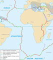
African Plate map-fr.png 1,610 × 1,820; 1.1 MB
-
AustralianPlate-sr.png 3,642 × 2,564; 498 KB
-
AustralianPlate.png 1,748 × 1,224; 326 KB
-
Eurasian Plate map-fr.png 3,325 × 1,255; 209 KB
-
Eurasian Plate map-sr.png 5,332 × 2,013; 948 KB
-
EurasianPlate-sr.png 7,250 × 4,717; 1.01 MB
-
EurasianPlate.png 1,740 × 1,130; 493 KB
-
Indian Plate map-fr.png 832 × 661; 356 KB
-
North American Plate map-fr.png 2,956 × 1,280; 1.63 MB
-
NorthAmericanPlate.png 1,400 × 1,500; 516 KB
-
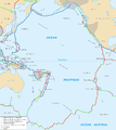
Pacific Plate map-fr.png 2,080 × 2,336; 1.82 MB
-
PacificPlate.png 1,740 × 2,264; 525 KB
-
Placa sudamericana (cropped).png 1,291 × 1,036; 793 KB
-
Placa sudamericana.png 1,302 × 1,050; 784 KB
-
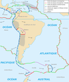
South American Plate map-fr.png 1,380 × 1,636; 1,006 KB
-
South American Plate map-sr.png 1,380 × 1,636; 817 KB
-
SouthAmericanPlate.png 1,376 × 1,440; 281 KB
-
Cape Orogeny A5.png 1,275 × 666; 23 KB
-
China map with craton and tectonic elements .png 1,800 × 1,263; 214 KB
-
China, North Korea, and South Korea map with craton and tectonic elements final 3.png 1,373 × 1,146; 199 KB
-
Location of North China Craton.png 1,559 × 1,125; 593 KB
-
Placement on craton.jpg 576 × 472; 41 KB
-
The location of Western Block of North China Craton.jpg 1,600 × 1,200; 88 KB
-
Formation of Cape Fold Mountains.jpg 4,921 × 5,061; 942 KB
-
Geology of Kimberley (Western Australia) Tectonic Evolution (a).png 1,866 × 999; 336 KB
-
Geology of Kimberley (Western Australia) Tectonic Evolution (c).png 1,866 × 1,001; 386 KB
-
Geology of Kimberley (Western Australia) Tectonic Evolution (d).png 1,866 × 1,001; 441 KB
-
Grenville-Timeline.png 571 × 738; 36 KB
-
Location Map of the CAOB.png 1,441 × 691; 466 KB
-
Russian Geologic Regions.svg 2,100 × 1,346; 5.37 MB
-
Saldanian orogeny A5.gif 1,275 × 604; 21 KB
-
Cross Section of Sicilian orogen (Revised at 20111107).svg 691 × 483; 432 KB
-
Cross section of Sicilian orogen.svg 691 × 483; 392 KB
-
Geological cross section of Sicily revised 20171221.svg 691 × 483; 423 KB
-
Simplified cross section of Sicilian orogen (detail-added).svg 691 × 483; 435 KB
-
Simplified cross section of Sicilian orogen (revised 20171116).svg 691 × 483; 426 KB
-
Simplified cross section of Sicilian orogen.svg 691 × 483; 394 KB
-
Teton fault block (it).jpg 2,222 × 1,594; 796 KB
-
Teton fault block.jpg 400 × 254; 26 KB
-
Teton region in the Early Ordovician.jpg 507 × 385; 33 KB
-
Westmusgrave.jpg 1,228 × 776; 267 KB


