Category:Ordsall, Nottinghamshire
Jump to navigation
Jump to search
English: Ordsall is a village in Nottinghamshire, England, 1 mile south of Retford.The parish church of All Saints is 13th century.
village in Nottinghamshire, United Kingdom  | |||||
| Upload media | |||||
| Instance of | |||||
|---|---|---|---|---|---|
| Location | Bassetlaw, Nottinghamshire, East Midlands, England | ||||
 | |||||
Subcategories
This category has the following 2 subcategories, out of 2 total.
A
Media in category "Ordsall, Nottinghamshire"
The following 31 files are in this category, out of 31 total.
-
 All Hallows Church in Ordsall - geograph.org.uk - 6648448.jpg 4,981 × 3,488; 3.7 MB
-
 All Hallows Street, Ordsall.jpg 1,280 × 960; 325 KB
-
 Bench Mark, Church of All Hallows, Ordsall - geograph.org.uk - 4698008.jpg 1,104 × 1,280; 543 KB
-
 Brecks Road - geograph.org.uk - 6155467.jpg 1,024 × 768; 201 KB
-
 Bridleway to Morton - geograph.org.uk - 221279.jpg 640 × 480; 104 KB
-
 Cheyne Walk, Ordsall - geograph.org.uk - 5687073.jpg 1,024 × 768; 116 KB
-
 Early autumn on Ollerton Road, Retford - geograph.org.uk - 6625069.jpg 1,600 × 1,200; 558 KB
-
 Former School Hall, Ordsall.jpg 1,280 × 960; 345 KB
-

-
 Goosemoor Lane Bridge, Ordsall - geograph.org.uk - 6648444.jpg 4,966 × 3,667; 5.74 MB
-
 Grace Road, Ordsall - geograph.org.uk - 5687076.jpg 1,024 × 768; 122 KB
-
 House by The River Idle at Ordsall - geograph.org.uk - 6648551.jpg 3,628 × 4,891; 5.27 MB
-
 Ollerton Road, Ordsall (1) - geograph.org.uk - 5687082.jpg 1,024 × 768; 191 KB
-
 Ollerton Road, Ordsall (2) - geograph.org.uk - 5687086.jpg 1,024 × 768; 159 KB
-
 Ordsall Road, Ordsall (2) - geograph.org.uk - 5687074.jpg 1,024 × 768; 129 KB
-
 Ordsall Road, Ordsall - geograph.org.uk - 6648481.jpg 5,155 × 3,706; 6.31 MB
-
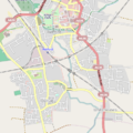 Ordsall, Retford.png 450 × 450; 307 KB
-
 Retford, aerial 2019 (1) - geograph.org.uk - 6288666.jpg 640 × 427; 99 KB
-
 Retford, aerial 2019 (2) - geograph.org.uk - 6288669.jpg 800 × 533; 158 KB
-
 The Gate Inn, Ordsall (geograph 5837113).jpg 640 × 480; 90 KB
-
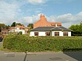
 The Grange, Ordsall.jpg 1,280 × 960; 278 KB
-
 The Plough Inn, Ordsall - geograph.org.uk - 4698019.jpg 1,280 × 960; 244 KB
-
 West Hill Road, Ordsall - geograph.org.uk - 1882303.jpg 1,024 × 634; 413 KB
-
 Westhill Community Centre, Ordsall - geograph.org.uk - 6648552.jpg 5,063 × 3,689; 4.3 MB
-
 Anyone need a spare tyre^ - geograph.org.uk - 700198.jpg 640 × 346; 84 KB
-
 Driving me around the bend - geograph.org.uk - 686870.jpg 640 × 429; 103 KB
-

-
 Entering Ordsall - geograph.org.uk - 700200.jpg 640 × 480; 62 KB
-

-
 Log barrier and target - geograph.org.uk - 700193.jpg 640 × 402; 93 KB
-
 Waiting at Grove Road railway crossing - geograph.org.uk - 700203.jpg 640 × 480; 105 KB


_-_geograph.org.uk_-_5687082.jpg)
_-_geograph.org.uk_-_5687086.jpg)
_-_geograph.org.uk_-_5687074.jpg)

_-_geograph.org.uk_-_6288666.jpg)
_-_geograph.org.uk_-_6288669.jpg)
.jpg)


