Category:Ordnance Survey New Popular Edition (6th Edition) (1940-1947) 1:63360 (full sheets)
Jump to navigation
Jump to search
This series covered England and Wales, but not Scotland. In anticipation of a single numbering system for Great Britain (which was implemented in the Seventh Series) the maps were numbered 64,71,75-78 & 82-190.
Media in category "Ordnance Survey New Popular Edition (6th Edition) (1940-1947) 1:63360 (full sheets)"
The following 117 files are in this category, out of 117 total.
-
 Ordnance Survey One-Inch Sheet 64 Berwick-upon-Tweed, Published 1947.jpg 10,971 × 12,777; 24.02 MB
-
 Ordnance Survey One-Inch Sheet 71 Alnwick, Published 1947.jpg 10,849 × 12,736; 16.19 MB
-
 Ordnance Survey One-Inch Sheet 75 Dumfries, Published 1947.jpg 10,910 × 12,758; 15.01 MB
-
 Ordnance Survey One-Inch Sheet 76 Carlisle, Published 1947.jpg 11,008 × 12,797; 16.57 MB
-
 Ordnance Survey One-Inch Sheet 77 Hexham, Published 1947.jpg 10,960 × 12,814; 18.36 MB
-
 Ordnance Survey One-Inch Sheet 78 Newcastle upon Tyne, Published 1947.jpg 10,948 × 12,799; 58.81 MB
-
 Ordnance Survey One-Inch Sheet 82 Keswick, Published 1947.jpg 8,216 × 9,573; 9.63 MB
-
 Ordnance Survey One-Inch Sheet 83 Penrith, Published 1947.jpg 8,199 × 9,555; 10.96 MB
-
 Ordnance Survey One-Inch Sheet 84 Teesdale, Published 1947.jpg 10,936 × 12,785; 16.06 MB
-
 Ordnance Survey One-Inch Sheet 85 Durham, Published 1947.jpg 10,959 × 12,754; 16.09 MB
-
 Ordnance Survey One-Inch Sheet 86 Redcar & Whitby, Published 1947.jpg 10,906 × 12,809; 16.21 MB
-
 Ordnance Survey One-Inch Sheet 88 Barrow in Furness, Published 1947.jpg 8,238 × 9,578; 9.12 MB
-
 Ordnance Survey One-Inch sheet 89 Lancaster and Kendal, published 1947.jpg 8,174 × 9,601; 10.93 MB
-
 Ordnance Survey One-Inch Sheet 90 Askrigg & Settle, Published 1947.jpg 11,023 × 12,801; 18.97 MB
-
 Ordnance Survey One-Inch Sheet 91 Ripon, Published 1947.jpg 10,968 × 12,789; 16.02 MB
-
 Ordnance Survey One-Inch Sheet 92 Pickering, Published 1947.jpg 10,979 × 12,773; 17.3 MB
-
 Ordnance Survey One-Inch Sheet 93 Scarborough, Published 1947.jpg 10,989 × 12,852; 11.17 MB
-
 Ordnance Survey One-Inch Sheet 94 Preston, Published 1947.jpg 10,969 × 12,750; 17.44 MB
-
 Ordnance Survey One-Inch Sheet 95 Blackburn & Burnley, Published 1947.jpg 10,928 × 12,741; 18.88 MB
-
 Ordnance Survey One-Inch Sheet 96 Leeds & Bradford, Published 1947.jpg 10,963 × 12,801; 19.24 MB
-
 Ordnance Survey One-Inch Sheet 97 York, Published 1947.jpg 10,949 × 12,768; 14.95 MB
-
 Ordnance Survey One-Inch Sheet 98 Market Weighton, Published 1947.jpg 10,963 × 12,738; 14.55 MB
-
 Ordnance Survey One-Inch Sheet 99 Hull, Published 1947.jpg 8,469 × 10,479; 8.29 MB
-
 Ordnance Survey One-Inch Sheet 100 Liverpool, Published 1947.jpg 10,933 × 12,775; 16.46 MB
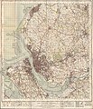
-
 Ordnance Survey One-Inch Sheet 101 Manchester, Published 1947.jpg 10,980 × 12,813; 19.29 MB
-
 Ordnance Survey One-Inch Sheet 102 Huddersfield, Published 1947.jpg 10,947 × 12,839; 16.3 MB
-
 Ordnance Survey One-Inch Sheet 103 Doncaster, Published 1947.jpg 10,941 × 12,783; 17.15 MB
-
 Ordnance Survey One-Inch Sheet 104 Gainsborough, Published 1947.jpg 10,954 × 12,817; 14.01 MB
-
 Ordnance Survey One-Inch Sheet 105 Grimbsy, Published 1946.jpg 10,855 × 12,736; 12.27 MB
-
 Ordnance Survey One-Inch Sheet 106 Anglesey, Published 1947.jpg 8,254 × 9,572; 8.72 MB
-
 Ordnance Survey One-Inch Sheet 107 Snowdon, Published 1947.jpg 8,246 × 9,572; 11.69 MB
-
 Ordnance Survey One-Inch Sheet 108 Denbigh, Published 1947.jpg 10,905 × 12,810; 18.51 MB
-
 Ordnance Survey One-Inch Sheet 109 Chester, Published 1947.jpg 10,942 × 12,772; 17.37 MB
-
 Ordnance Survey One-Inch Sheet 110 Stoke on Trent, Published 1947.jpg 10,921 × 12,787; 18.03 MB
-
 Ordnance Survey One-Inch Sheet 111 Buxton and Matlock, Published 1947.jpg 8,165 × 9,535; 12.98 MB
-
 Ordnance Survey One-Inch Sheet 112 Nottingham, Published 1947.jpg 10,875 × 12,765; 15.9 MB
-
 Ordnance Survey One-Inch Sheet 113 Lincoln & Grantham, Published 1947.jpg 11,030 × 12,825; 14.01 MB
-
 Ordnance Survey One-Inch Sheet 114 Boston & Skegness, Published 1947.jpg 10,945 × 12,789; 14.8 MB
-
 Ordnance Survey One-Inch Sheet 115 Pwllheli, Published 1947.jpg 10,928 × 12,820; 11.27 MB
-
 Ordnance Survey One-Inch Sheet 116 Dolgelley, Published 1947.jpg 8,225 × 9,535; 11.25 MB
-
 Ordnance Survey One-Inch Sheet 117 Bala & Welshpool, Published 1947.jpg 10,907 × 12,776; 18.42 MB
-
 Ordnance Survey One-Inch Sheet 118 Shrewsbury, Published 1947.jpg 10,951 × 12,826; 16.51 MB
-
 Ordnance Survey One-Inch Sheet 119 Stafford, Published 1946.jpg 10,861 × 12,747; 16.25 MB
-
 Ordnance Survey One-Inch Sheet 120 Derby & Burton upon Trent, Published 1947.jpg 10,965 × 12,819; 16.63 MB
-
 Ordnance Survey One-Inch Sheet 121 Derby Nottingham and Leicester, Published 1946.jpg 10,891 × 12,823; 16.04 MB
-
 Ordnance Survey One-Inch Sheet 122 Melton Mowbray, Published 1947.jpg 10,858 × 12,737; 15.22 MB
-
 Ordnance Survey One-Inch Sheet 123 Spalding, Published 1946.jpg 10,924 × 12,746; 14.15 MB
-
 Ordnance Survey One-Inch Sheet 124 King's Lynn, Published 1946.jpg 10,958 × 12,774; 13.86 MB
-
 Ordnance Survey One-Inch Sheet 125 Fakenham, Published 1946.jpg 10,951 × 12,854; 57.05 MB
-
 Ordnance Survey One-Inch Sheet 126 Norwich, Published 1945.jpg 10,917 × 12,845; 13.74 MB
-
 Ordnance Survey One-Inch Sheet 127 Aberystwyth, Published 1947.jpg 10,941 × 12,796; 15.23 MB
-
 Ordnance Survey One-Inch Sheet 128 Montgomery and Llandrindod Wells, Published 1947.jpg 8,180 × 9,568; 12.17 MB
-
 Ordnance Survey One-Inch Sheet 129 Ludlow, Published 1947.jpg 10,831 × 12,721; 17.96 MB
-
 Ordnance Survey One-Inch Sheet 130 Kidderminster, Published 1947.jpg 10,921 × 12,779; 18.93 MB
-
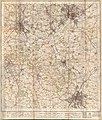
 Ordnance Survey One-Inch Sheet 131 Birmingham, Published 1947.jpg 10,955 × 12,776; 17.49 MB
-
 Ordnance Survey One-Inch Sheet 132 Coventry and Rugby, Published 1946 (Cov-Nun crop).jpg 1,500 × 3,234; 5.36 MB
-
 Ordnance Survey One-Inch Sheet 132 Coventry and Rugby, Published 1946 (Rug-Leam-Dav crop).jpg 6,000 × 3,146; 20.42 MB
-
 Ordnance Survey One-Inch Sheet 132 Coventry and Rugby, Published 1946.jpg 10,949 × 12,818; 15.65 MB
-
 OS Daventry 1946 map.jpg 1,117 × 1,105; 1.19 MB
-
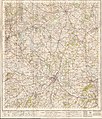
 Ordnance Survey One-Inch Sheet 133 Northampton, Published 1946.jpg 10,919 × 12,787; 15.02 MB
-
 Ordnance Survey One-Inch Sheet 134 Huntingdon & Peterborough, Published 1946.jpg 10,967 × 12,765; 14.72 MB
-
 Ordnance Survey One-Inch Sheet 135 Cambridge & Ely, Published 1946.jpg 10,887 × 12,781; 13.51 MB
-
 Ordnance Survey One-Inch Sheet 136 Bury St Edmunds, Published 1946.jpg 8,223 × 9,614; 9.99 MB
-
 Ordnance Survey One-Inch Sheet 137 Lowestoft, Published 1946.jpg 10,949 × 12,810; 14.82 MB
-
 Ordnance Survey One-Inch Sheet 138 Fishguard, Published 1947.jpg 11,275 × 12,741; 13.14 MB
-
 Ordnance Survey One-Inch Sheet 139 Cardigan, Published 1947.jpg 10,928 × 12,772; 16.12 MB
-
 Ordnance Survey One-Inch Sheet 140 Llandovery, Published 1947.jpg 11,002 × 12,763; 17.55 MB
-
 Ordnance Survey One-Inch Sheet 141 Brecon, Published 1947.jpg 10,968 × 12,800; 18.42 MB
-
 Ordnance Survey One-Inch Sheet 142 Hereford, Published 1947.jpg 8,167 × 9,565; 12.27 MB
-
 Ordnance Survey One-Inch Sheet 143 Gloucester & Malvern, Published 1946.jpg 8,181 × 9,556; 12.07 MB
-
 Ordnance Survey One-Inch Sheet 144 Cheltenham & Evesham, Published 1946.jpg 10,983 × 12,830; 16.59 MB
-
 Ordnance Survey One-Inch Sheet 145 Banbury, Published 1946.jpg 10,915 × 12,798; 15.92 MB
-
 Ordnance Survey One-Inch Sheet 146 Buckingham, Published 1947.jpg 10,967 × 12,804; 15.89 MB
-
 Ordnance Survey One-Inch Sheet 147 Bedford & Luton, Published 1946.jpg 10,927 × 12,773; 17.07 MB
-
 Ordnance Survey One-Inch Sheet 148 Saffron Walden, Published 1946.jpg 10,931 × 12,776; 16.21 MB
-
 Ordnance Survey One-Inch Sheet 149 Colchester, Published 1946.jpg 10,992 × 12,810; 16.25 MB
-
 Ordnance Survey One-Inch Sheet 150 Ipswich, Published 1946.jpg 11,004 × 12,810; 12.76 MB
-
 Ordnance Survey One-Inch Sheet 151 Pembroke, Published 1946.jpg 8,471 × 9,540; 8.72 MB
-
 Ordnance Survey One-Inch Sheet 152 Carmarthen and Tenby, Published 1946.jpg 10,911 × 12,829; 12.43 MB
-
 Ordnance Survey One-Inch Sheet 153 Swansea, Published 1947.jpg 10,928 × 12,766; 16.35 MB
-
 Ordnance Survey One-Inch Sheet 154 Cardiff, Published 1947.jpg 10,917 × 12,746; 66.06 MB
-
 Ordnance Survey One-Inch Sheet 155 Bristol & Newport, Published 1946.jpg 10,929 × 12,822; 17.45 MB
-
 Ordnance Survey One-Inch Sheet 156 Bristol & Stroud, Published 1946.jpg 10,939 × 12,823; 18.14 MB
-
 Ordnance Survey One-Inch Sheet 157 Swindon, Published 1940.jpg 8,198 × 9,537; 10.75 MB
-
 Ordnance Survey One-Inch Sheet 158 Oxford & Newbury, Published 1940.jpg 8,243 × 9,601; 11.05 MB
-
 Ordnance Survey One-Inch Sheet 159 The Chilterns, Published 1945.jpg 8,187 × 9,575; 12.08 MB
-
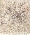
 Ordnance Survey One-Inch Sheet 160 London NW, Published 1945.jpg 10,896 × 12,793; 18.93 MB
-
 Ordnance Survey One-Inch Sheet 161 London NE, Published 1940.jpg 11,021 × 12,814; 17.22 MB
-
 Ordnance Survey One-Inch Sheet 162 Southend-on-Sea, Published 1945.jpg 8,192 × 9,569; 11.03 MB
-
 Ordnance Survey One-Inch Sheet 163 Barnstaple, Published 1946.jpg 8,183 × 9,579; 10.79 MB
-
 Ordnance Survey One-Inch Sheet 164 Minehead, Published 1946.jpg 8,180 × 9,562; 11.42 MB
-
 Ordnance Survey One-Inch Sheet 165 Weston-Super-Mare, Published 1946.jpg 8,197 × 9,554; 10.63 MB
-
 Ordnance Survey One-Inch Sheet 166 Frome, Published 1946.jpg 8,176 × 9,595; 11.4 MB
-
 Ordnance Survey One-Inch Sheet 167 Salisbury, Published 1940.jpg 8,211 × 9,424; 9.6 MB
-
 Ordnance Survey One-Inch Sheet 168 Wincheste, Published 1945.jpg 10,993 × 12,808; 16.85 MB
-
 Ordnance Survey One-Inch Sheet 169 Aldershot, Published 1940.jpg 8,245 × 9,566; 11.92 MB
-
 Ordnance Survey One-Inch Sheet 170 London SW, Published 1945.jpg 8,187 × 9,560; 13.79 MB
-
 Ordnance Survey One-Inch Sheet 171 London SE, Published 1940.jpg 8,238 × 9,581; 13.91 MB
-
 Ordnance Survey One-Inch Sheet 172 Chatham & Maidstone, Published 1940.jpg 10,979 × 12,747; 17 MB
-
 Ordnance Survey One-Inch Sheet 173 East Kent, Published 1945.jpg 10,987 × 12,763; 14.79 MB
-
 Ordnance Survey One-Inch Sheet 174 Bude, Published 1946.jpg 8,185 × 9,539; 8.65 MB
-
 Ordnance Survey One-Inch Sheet 175 Okehampton, Published 1946.jpg 8,202 × 9,576; 12.07 MB
-
 Ordnance Survey One-Inch Sheet 176 Exeter, Published 1946.jpg 8,211 × 9,535; 11.2 MB
-
 Ordnance Survey One-Inch Sheet 177 Taunton & Lyme Regis, Published 1946.jpg 8,250 × 9,531; 11.26 MB
-
 Ordnance Survey One-Inch Sheet 178 Dorchester, Published 1945.jpg 8,196 × 9,562; 11.16 MB
-
 Ordnance Survey One-Inch Sheet 179 Bournemouth, Published 1940.jpg 8,218 × 9,543; 10.36 MB
-
 Ordnance Survey One-Inch Sheet 180 The Solent, Published 1945.jpg 8,163 × 9,570; 10.68 MB
-
 Ordnance Survey One-Inch Sheet 181 Chichester, Published 1945.jpg 8,193 × 9,555; 11.25 MB
-
 Ordnance Survey One-Inch Sheet 182 Brighton & Worthing, Published 1940.jpg 8,191 × 9,533; 12.01 MB
-
 Ordnance Survey One-Inch Sheet 183 Eastbourne, Published 1940.jpg 8,194 × 9,537; 11.71 MB
-
 Ordnance Survey One-Inch Sheet 184 Hastings, Published 1940.jpg 8,229 × 9,562; 10.72 MB
-
 Ordnance Survey One-Inch Sheet 185 Newquay & Padstow, Published 1946.jpg 8,199 × 9,557; 7.83 MB
-
 Ordnance Survey One-Inch Sheet 186 Bodmin and Launceston, Published 1946.jpg 8,242 × 9,593; 10.18 MB
-
 Ordnance Survey One-Inch Sheet 187 Plymouth, Published 1946.jpg 8,224 × 9,566; 10.78 MB
-
 Ordnance Survey One-Inch Sheet 188 Torquay, Published 1946.jpg 8,209 × 9,562; 10.84 MB
-
 Ordnance Survey One-Inch Map Sheet 189 Land's End (1946).jpg 8,220 × 9,605; 7.51 MB
-
 Ordnance Survey One-Inch Sheet 190 Truro and Falmouth, Published 1946.jpg 8,186 × 9,581; 8.52 MB


.jpg)
.jpg)


.jpg)
