Category:Ordnance Survey 1:253440 maps
Jump to navigation
Jump to search
Subcategories
This category has the following 3 subcategories, out of 3 total.
Media in category "Ordnance Survey 1:253440 maps"
The following 11 files are in this category, out of 11 total.
-
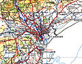 Cardiffmap1946.jpg 2,000 × 1,568; 3.09 MB
-
 Carmarthenshiremap1946.jpg 6,992 × 5,072; 5.23 MB
-
 Fourth Edition Ordnance Survey quarter-inch map numbers.jpg 1,608 × 3,764; 823 KB
-
 Isle of Angleseymap 1946.jpg 4,747 × 3,862; 4.73 MB
-
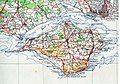 IsleofWightmap 1945.jpg 2,264 × 1,576; 996 KB
-
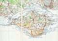 IsleofWightmap 1945needs fix.jpg 4,528 × 3,152; 1.66 MB
-
 Milford Haven harbourmap1946.jpg 3,200 × 2,208; 820 KB
-
 Ordnance Survey ARMY AIR Sheet 8 Orkneys.jpg 6,367 × 8,231; 5.1 MB
-
 Ordnance Survey Neolithic Wessex, published 1932.jpg 12,428 × 9,157; 10.29 MB
-
 Ordnance Survey Small Scale Description Quarter Inch Plate 12.jpg 2,219 × 3,900; 692 KB
-
 Swindon map 1945.jpg 1,173 × 833; 146 KB


