Category:Ordnance Survey 1:25000 maps
Jump to navigation
Jump to search
Subcategories
This category has the following 4 subcategories, out of 4 total.
Media in category "Ordnance Survey 1:25000 maps"
The following 17 files are in this category, out of 17 total.
-
 Balerno Loop 25000 Composite.jpg 6,500 × 3,776; 6.62 MB
-
 Composite map of Festiniog Railway Ordnance Survey 1 25000.jpg 7,846 × 7,884; 6.17 MB
-
 Devizes locks plan.png 937 × 314; 603 KB
-
 Dunmail Raise OS Sheet NY 30 31 Composite.jpg 3,712 × 9,264; 17.11 MB
-
 Northumberland Coast 1954 Composite Map.jpg 19,877 × 32,856; 70.38 MB
-
 Ordnance Survey 25000 First Series Index.jpg 3,669 × 7,364; 2.61 MB
-
 Ordnance Survey Composite Slater's Loup.jpg 2,136 × 1,503; 1.25 MB
-
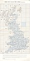
 Ordnance Survey Plate 8 Index England & Wales.jpg 5,945 × 6,639; 3.59 MB
-
 Ordnance Survey Plate 9 Index Scotland.jpg 5,348 × 7,346; 3.34 MB
-

-

-

-
 OS Composite map from NT 06 07 16 17.jpg 6,233 × 3,800; 2.75 MB
-
 OS Composite map from SE 99 98 TA 08.jpg 8,478 × 5,173; 7.22 MB
-
 Osmaps-bridleway.png 500 × 333; 9 KB
-
 Osmaps-footpath.png 500 × 333; 8 KB
-


_Dunsyre,_Published_1950_Melbourne_Lanarkshire.png)
_Royston,_Published_c1949_cropped_Meldreth_and_Cement_works.jpg)
_Eye,_Published_1947_cropped_to_show_Brome_and_Brome_Hall.png)


