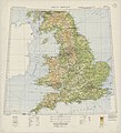
Category:Ordnance Survey 1:1000000 maps
Jump to navigation
Jump to search
Media in category "Ordnance Survey 1:1000000 maps"
The following 7 files are in this category, out of 7 total.
-
Ordnance Survey Dark Ages Great Britain Map, Published 1965.jpg 9,435 × 12,411; 8.81 MB
-
Ordnance Survey Dark Ages North Sheet Map, Published 1938.jpg 7,032 × 10,323; 5.84 MB
-
Ordnance Survey Dark Ages South Sheet Map, Published 1935.jpg 7,015 × 10,316; 7.36 MB
-
Ordnance Survey Great Britain Sheet 1, Published 1933.jpg 11,753 × 13,696; 37.51 MB
-
Ordnance Survey Great Britain Sheet 2, Published 1933.jpg 12,412 × 13,632; 40.67 MB
-
Ordnance Survey Map of Roman Britain, Published 1956.jpg 9,334 × 12,647; 8.63 MB
-
Ordnance Survey Physical Map of Scotland, Published 1928.jpg 10,316 × 13,576; 32.05 MB


