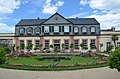
Category:Orangerie (Bad Homburg vor der Höhe)
Jump to navigation
Jump to search
| Object location | | View all coordinates using: OpenStreetMap |
|---|
| Upload media | |||||
| Instance of | |||||
|---|---|---|---|---|---|
| Location | Bad Homburg vor der Höhe, Hochtaunuskreis, Darmstadt Government Region, Hesse, Germany | ||||
| Heritage designation | |||||
 | |||||
Media in category "Orangerie (Bad Homburg vor der Höhe)"
The following 2 files are in this category, out of 2 total.
-
 Bad Homburg, die Orangerie.jpg 2,551 × 1,579; 1.7 MB
-
 Bad Homburg, Schloss, Orangerie.jpg 4,912 × 3,232; 8.74 MB

