Category:Opencast Way
Jump to navigation
Jump to search
Media in category "Opencast Way"
The following 35 files are in this category, out of 35 total.
-
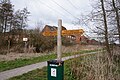 Fingerpost on the Opencast Way - geograph.org.uk - 4877882.jpg 1,600 × 1,065; 760 KB
-
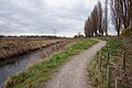
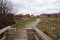
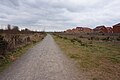
 Opencast Way alongside Bottesford Beck - geograph.org.uk - 4877865.jpg 1,600 × 1,065; 869 KB
-
 Opencast Way alongside Bottesford Beck - geograph.org.uk - 4877867.jpg 1,600 × 1,065; 599 KB
-
 Opencast Way alongside Bottesford Beck - geograph.org.uk - 4877894.jpg 1,600 × 1,065; 804 KB
-
 Opencast Way alongside Bottesford Beck - geograph.org.uk - 4877897.jpg 1,600 × 1,065; 747 KB
-
 Opencast Way alongside Bottesford Beck - geograph.org.uk - 4877946.jpg 1,600 × 1,065; 656 KB
-
 Opencast Way alongside Bottesford Beck - geograph.org.uk - 4877974.jpg 1,600 × 1,065; 711 KB
-
 Opencast Way alongside Bottesford Beck - geograph.org.uk - 4877977.jpg 1,600 × 1,065; 691 KB
-
 Opencast Way alongside Bottesford Beck - geograph.org.uk - 4877983.jpg 1,600 × 1,065; 678 KB
-
 Opencast Way at Ashby Vile (pond) - geograph.org.uk - 4877734.jpg 1,600 × 1,065; 924 KB
-
 Opencast Way at Ashby Vile (pond) - geograph.org.uk - 4877749.jpg 1,600 × 1,065; 528 KB
-
 Opencast Way at Ashby Vile (pond) - geograph.org.uk - 4877754.jpg 1,600 × 1,065; 505 KB
-
 Opencast Way at Ashby Vile (pond) - geograph.org.uk - 4877760.jpg 1,600 × 1,065; 596 KB
-
 Opencast Way at Ashby Vile (pond) - geograph.org.uk - 4877762.jpg 1,600 × 1,065; 685 KB
-
 Opencast Way at Ashby Vile (pond) - geograph.org.uk - 4877765.jpg 1,600 × 1,065; 730 KB
-
 Opencast Way at Ashby Vile (pond) - geograph.org.uk - 4877769.jpg 1,600 × 1,065; 616 KB
-
 Opencast Way at Ashby Vile (pond) - geograph.org.uk - 4877775.jpg 1,600 × 1,065; 552 KB
-
 Opencast Way at Ashby Vile (pond) - geograph.org.uk - 4877779.jpg 1,600 × 1,065; 486 KB
-
 Opencast Way at Ashby Vile (pond) - geograph.org.uk - 4877780.jpg 1,600 × 1,065; 490 KB
-
 Opencast Way at Ashby Vile (pond) - geograph.org.uk - 4877782.jpg 1,600 × 1,065; 621 KB
-
 Opencast Way at Ashby Vile (pond) - geograph.org.uk - 4877785.jpg 1,600 × 1,065; 430 KB
-
 Opencast Way at Ashby Vile (pond) - geograph.org.uk - 4877812.jpg 1,600 × 1,065; 530 KB
-
 Opencast Way at Ashby Vile (pond) - geograph.org.uk - 4877817.jpg 1,600 × 1,065; 982 KB
-
 Opencast Way at Ashby Vile (pond) - geograph.org.uk - 4877818.jpg 1,600 × 1,065; 605 KB
-
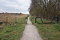
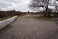
 Opencast Way at Emanuel Bridge - geograph.org.uk - 4877703.jpg 1,600 × 1,065; 860 KB
-
 Opencast Way in Emanuel Strip (wood) - geograph.org.uk - 4877713.jpg 1,600 × 1,065; 1,006 KB
-
 Opencast Way in Emanuel Strip (wood) - geograph.org.uk - 4877716.jpg 1,600 × 1,065; 974 KB
-
 Opencast Way in Emanuel Strip (wood) - geograph.org.uk - 4877718.jpg 1,600 × 1,065; 898 KB
-
 Opencast Way in Emanuel Strip (wood) - geograph.org.uk - 4877723.jpg 1,600 × 1,065; 767 KB
-
 Opencast Way in Emanuel Strip (wood) - geograph.org.uk - 4877726.jpg 1,600 × 1,065; 740 KB
-
 Opencast Way in Emanuel Strip (wood) - geograph.org.uk - 4877728.jpg 1,600 × 1,065; 1,022 KB
-
 Opencast Way in Emanuel Strip (wood) - geograph.org.uk - 4877733.jpg 1,600 × 1,065; 1,007 KB
-
 Opencast Way towards Brat Hill - geograph.org.uk - 4877835.jpg 1,600 × 1,065; 463 KB
-
 Opencast Way towards Brat Hill - geograph.org.uk - 4877843.jpg 1,600 × 1,065; 584 KB
-
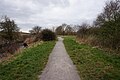
 Opencast Way towards Emanuel Strip (wood) - geograph.org.uk - 4877708.jpg 1,600 × 1,065; 696 KB


_-_geograph.org.uk_-_4877734.jpg)
_-_geograph.org.uk_-_4877749.jpg)
_-_geograph.org.uk_-_4877754.jpg)
_-_geograph.org.uk_-_4877760.jpg)
_-_geograph.org.uk_-_4877762.jpg)
_-_geograph.org.uk_-_4877765.jpg)
_-_geograph.org.uk_-_4877769.jpg)
_-_geograph.org.uk_-_4877775.jpg)
_-_geograph.org.uk_-_4877779.jpg)
_-_geograph.org.uk_-_4877780.jpg)
_-_geograph.org.uk_-_4877782.jpg)
_-_geograph.org.uk_-_4877785.jpg)
_-_geograph.org.uk_-_4877812.jpg)
_-_geograph.org.uk_-_4877817.jpg)
_-_geograph.org.uk_-_4877818.jpg)

_-_geograph.org.uk_-_4877713.jpg)
_-_geograph.org.uk_-_4877716.jpg)
_-_geograph.org.uk_-_4877718.jpg)
_-_geograph.org.uk_-_4877723.jpg)
_-_geograph.org.uk_-_4877726.jpg)
_-_geograph.org.uk_-_4877728.jpg)
_-_geograph.org.uk_-_4877733.jpg)


_-_geograph.org.uk_-_4877708.jpg)