Category:OpenStreetMap maps of communes in Auvergne-Rhône-Alpes
Jump to navigation
Jump to search
Administrative regions and territorial collectivity of Metropolitan France (‡ since start of 2016):
Auvergne-Rhône-Alpes‡ · Bourgogne-Franche-Comté‡ · Brittany · Centre-Val de Loire · Corsica · Grand Est‡ · Hauts-de-France‡ · Île-de-France · Normandy‡ · New Aquitaine‡ · Occitania‡ · Pays de la Loire · Provence-Alpes-Côte d'Azur
Auvergne-Rhône-Alpes‡ · Bourgogne-Franche-Comté‡ · Brittany · Centre-Val de Loire · Corsica · Grand Est‡ · Hauts-de-France‡ · Île-de-France · Normandy‡ · New Aquitaine‡ · Occitania‡ · Pays de la Loire · Provence-Alpes-Côte d'Azur

Subcategories
This category has only the following subcategory.
Media in category "OpenStreetMap maps of communes in Auvergne-Rhône-Alpes"
The following 2 files are in this category, out of 2 total.
-
 Grenoble polygone scientifique map.svg 1,075 × 568; 1.79 MB
-
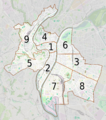 Lyon et ses arrondissements map-numbers.png 1,402 × 1,583; 1.74 MB

