Category:OpenStreetMap maps of Tel Aviv
Jump to navigation
Jump to search
Media in category "OpenStreetMap maps of Tel Aviv"
The following 14 files are in this category, out of 14 total.
-
Ben Gurion Osm Map.png 1,358 × 924; 855 KB
-
Bialik street on Tel-Aviv map.png 875 × 974; 1.16 MB
-
Levant Fair Map.svg 411 × 490; 870 KB
-
Map messe TLV.png 1,085 × 1,227; 917 KB
-
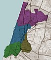
Tel Aviv districts map.jpg 735 × 855; 199 KB
-
Tel Aviv location map.png 271 × 475; 136 KB
-
Tel Aviv White City WHS.svg 600 × 1,000; 4.07 MB
-
TLV Map Ter 1.png 1,075 × 1,031; 321 KB
-
TLV Map Ter 1a.png 938 × 720; 486 KB
-
TLV Map Ter 3.png 1,224 × 1,114; 503 KB
-
TLV Map Ter 3a.png 1,044 × 888; 530 KB
-
TLV-Com-Sud.png 1,930 × 1,226; 624 KB
-
TLV-Com-Sud1.png 656 × 649; 154 KB
-
Map TAU.png 887 × 1,313; 728 KB


