Category:OpenStreetMap maps of Tanzania
Jump to navigation
Jump to search
Media in category "OpenStreetMap maps of Tanzania"
The following 8 files are in this category, out of 8 total.
-
 Akagera map.png 1,179 × 819; 1.73 MB
-
 Latham Island, Tanzania.png 679 × 609; 81 KB
-
 Lumbila Langenburg.png 1,098 × 870; 375 KB
-
 Mongo Island, Tanzania.png 1,418 × 855; 345 KB
-
 OSM Lushoto District.png 3,004 × 2,992; 11.08 MB
-
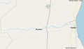 Saadani - Mvavi map.png 1,079 × 640; 104 KB
-
 Selous Game Reserve location map - 01.png 806 × 596; 272 KB
-
 Tanga Airport Map.svg 1,499 × 1,005; 395 KB


