Category:OpenStreetMap maps of Rio de Janeiro (state)
Jump to navigation
Jump to search
Subcategories
This category has only the following subcategory.
Media in category "OpenStreetMap maps of Rio de Janeiro (state)"
The following 6 files are in this category, out of 6 total.
-
 Bairro de Valverde em Nova Iguaçu.png 804 × 777; 358 KB
-
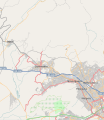
 Baixadariomap.svg 375 × 206; 5.22 MB
-
 Mapa de Nova Iguaçu.svg 738 × 850; 5.37 MB
-
 Mapa do bairro Olaria Nova Friburgo.png 1,362 × 841; 306 KB
-
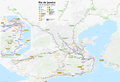 Public transport map of Rio de Janeiro.png 8,777 × 5,996; 15.03 MB
-
 Urca (Open Street Map).svg 1,113 × 1,166; 2.09 MB


.svg)