Category:OpenStreetMap maps of Oulu
Jump to navigation
Jump to search
Media in category "OpenStreetMap maps of Oulu"
The following 10 files are in this category, out of 10 total.
-
 Intio Oulu Map 20110621.svg 865 × 1,004; 1.16 MB
-
 Kontinkangas Oulu Map 20110621.svg 895 × 1,150; 1.46 MB
-
 Linnanmaan Campusalue.svg 816 × 1,090; 1.07 MB
-
 Meri-Toppila Oulu OSM 20191207.svg 1,336 × 1,484; 1.41 MB
-
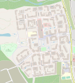
 Kaijonharju.svg 1,238 × 916; 1.27 MB
-
 Oulunkeskuskenttä1.jpg 1,432 × 1,160; 343 KB
-
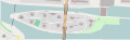
 Pikisaari Oulu Map 20110621.svg 1,379 × 1,275; 321 KB
-
 Raksila Oulu Map 20110621.svg 910 × 693; 1.09 MB
-
 Toivoniemi Oulu Map 20120609.svg 2,603 × 789; 599 KB
-
 Tuira Oulu Map 20110621.svg 1,795 × 986; 2.02 MB


