Category:OpenStreetMap maps of Ontario
Jump to navigation
Jump to search
Subcategories
This category has the following 3 subcategories, out of 3 total.
Media in category "OpenStreetMap maps of Ontario"
The following 53 files are in this category, out of 53 total.
-
1976 Olympic Course area's.png 834 × 710; 278 KB
-
2011 CSL season.png 1,047 × 743; 522 KB
-
Appleby, Ontario Map.png 511 × 511; 58 KB
-
Balsam Lake Map.svg 565 × 1,039; 2.67 MB
-
Bruce's Mill Conservation Area map.png 1,151 × 684; 264 KB
-
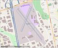
Buttonville Airport Street View.jpg 1,116 × 933; 141 KB
-
Central McDougall.svg 871 × 444; 2.63 MB
-
Centralia James T Field Memorial Airport.png 1,022 × 672; 173 KB
-
CFB BordenOpenstreet map.png 1,208 × 932; 887 KB
-
Chatham Kent Airport.png 967 × 673; 99 KB
-
CHUM FM broadcast area map.png 896 × 569; 590 KB
-
CING FM broadcast area.png 895 × 623; 549 KB
-
CIUX-FM broadcast area map.png 767 × 521; 529 KB
-
CKNX AM broadcast area map.png 878 × 592; 468 KB
-
Farlane station OSM map.png 1,047 × 625; 153 KB
-
Goderich CPR Station map.png 1,204 × 694; 260 KB
-
Goderich Municipal airport open street map.png 679 × 581; 82 KB
-
Greater Toronto.png 1,028 × 1,104; 1.15 MB
-
Hamilton Ontario International Airport.png 1,280 × 928; 298 KB
-
Highway 2 map.png 905 × 601; 516 KB
-
ION LRT map.svg 649 × 558; 678 KB
-
JerseyvilleMap.jpg 680 × 430; 92 KB
-
Lake Madawaska map.svg 1,926 × 541; 1.99 MB
-
ManitoulinIsland2022OSM.png 6,666 × 3,714; 8.66 MB
-
Map of Commanda Lake.png 511 × 725; 92 KB
-
Map of Kings University College.svg 1,081 × 916; 1.02 MB
-
Map of Lake Cecebe with highlighted edges.png 1,111 × 747; 309 KB
-
Mara Provincial Park OSM map.png 1,189 × 694; 281 KB
-
410 extension from Mayfield to Valleywood.svg 618 × 432; 197 KB
-
Mississauga City Centre.png 647 × 461; 429 KB
-
Mississauga explosion radius.png 823 × 771; 521 KB
-
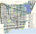
Mississauga overview map.svg 814 × 768; 751 KB
-
Muskoka Airport map.png 1,011 × 933; 238 KB
-
Newmarket Canal section map.png 1,275 × 694; 316 KB
-
North Bay Airport and CFB North Bay map.png 1,268 × 931; 298 KB
-
Ontario HOV lanes.jpg 855 × 722; 114 KB
-
Oscshuttlebus.png 868 × 790; 463 KB
-
OSM of Sault Ste Marie.png 1,274 × 874; 447 KB
-
Ottawa-Gatineau.png 984 × 785; 969 KB
-
Red Lake Mine OSM.png 1,234 × 832; 299 KB
-
St Thomas ON Municipal Airport.png 964 × 669; 115 KB
-
Stratford municipal airport.png 1,024 × 675; 94 KB
-
The Crack Trail map Alltrails OpenStreetMap.png 863 × 783; 308 KB
-
ThornhillInVaughan&Markham.jpg 872 × 452; 223 KB
-
ThousandIslands2022OSM.png 6,018 × 4,243; 12.13 MB
-
Thunder Bay Airport.png 941 × 667; 130 KB
-
Timmins airport open street map.png 980 × 899; 167 KB
-
VIA Sudbury-White River.svg 800 × 679; 577 KB
-
Victor Mine and airfield in Ontario.png 1,016 × 616; 51 KB
-
Windsor Airport.png 1,252 × 928; 254 KB
-
WTSS broadcast area map FCC.png 693 × 622; 349 KB
-
Yonge Street Extension Map.png 1,304 × 1,258; 1.3 MB
-
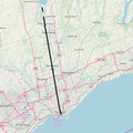
Yonge Street Map.png 680 × 680; 620 KB


