Category:OpenStreetMap maps of North Yorkshire
Jump to navigation
Jump to search
Media in category "OpenStreetMap maps of North Yorkshire"
The following 37 files are in this category, out of 37 total.
-
Bev-yrk-rail-wiki-merged.png 2,072 × 1,214; 442 KB
-
City of York Green Belt.svg 1,714 × 1,047; 1.56 MB
-
Cliftoningstopview.png 666 × 542; 333 KB
-
Location map United Kingdom Richmond.png 2,006 × 1,422; 846 KB
-
Location map United Kingdom Scarborough Old Town.png 2,006 × 1,339; 1.18 MB
-
Location map United Kingdom York Central.png 2,374 × 1,683; 3.91 MB
-
Location of clifton ings, York, UK.png 1,244 × 474; 444 KB
-
Locationoffossriverbarrierwithprotectedzone.png 640 × 480; 206 KB
-
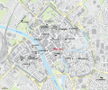
Map of medieval parish churches of York - All Saints, North Street.svg 1,086 × 906; 1.39 MB
-
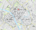
Map of medieval parish churches of York - All Saints, Pavement.svg 1,086 × 906; 1.42 MB
-
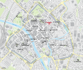
Map of medieval parish churches of York - Holy Trinity, Goodramgate.svg 1,086 × 906; 1.42 MB
-
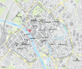
Map of medieval parish churches of York - Holy Trinity, Micklegate.svg 1,086 × 906; 1.42 MB
-
Map of medieval parish churches of York - St Andrew, St Andrewgate.svg 1,086 × 906; 1.42 MB
-
Map of medieval parish churches of York - St Crux, Pavement.svg 1,086 × 906; 1.42 MB
-
Map of medieval parish churches of York - St Cuthbert, Peasholme Green.svg 1,086 × 906; 1.42 MB
-
Map of medieval parish churches of York - St Denys, Walmgate.svg 1,086 × 906; 1.42 MB
-
Map of medieval parish churches of York - St Helen, Stonegate.svg 1,086 × 906; 1.42 MB
-
Map of medieval parish churches of York - St John, Micklegate.svg 1,086 × 906; 1.42 MB
-
Map of medieval parish churches of York - St Lawrence, Lawrence Street.svg 1,086 × 906; 1.42 MB
-
Map of medieval parish churches of York - St Margaret, Walmgate.svg 1,086 × 906; 1.42 MB
-
Map of medieval parish churches of York - St Martin, Coney Street.svg 1,086 × 906; 1.42 MB
-
Map of medieval parish churches of York - St Martin-cum-Gregory, Micklegate.svg 1,086 × 906; 1.42 MB
-
Map of medieval parish churches of York - St Mary, Bishophill Junior.svg 1,086 × 906; 1.42 MB
-
Map of medieval parish churches of York - St Mary, Castlegate.svg 1,086 × 906; 1.42 MB
-
Map of medieval parish churches of York - St Michael, Spurriergate.svg 1,086 × 906; 1.42 MB
-
Map of medieval parish churches of York - St Michael-le-Belfrey, High Petergate.svg 1,086 × 906; 1.42 MB
-
Map of medieval parish churches of York - St Olave, Marygate.svg 1,086 × 906; 1.42 MB
-
Map of medieval parish churches of York - St Sampson, Church Street.svg 1,086 × 906; 1.42 MB
-
Map of medieval parish churches of York - St Saviour, St Saviourgate.svg 1,086 × 906; 1.42 MB
-
Map of medieval parish churches of York.svg 1,086 × 906; 1.39 MB
-
Map Whip-Ma-Whop-Ma-Gate.svg 1,086 × 906; 2.05 MB
-
Mapof barrier.png 691 × 864; 221 KB
-
NCN Route 66 Beverley-York.png 2,200 × 1,100; 2.17 MB
-
OSM map of York UK 1.png 684 × 662; 209 KB
-
OSM map of York UK 2.png 672 × 627; 279 KB
-
Relative height of Great Shunner Fell.png 1,196 × 1,987; 3.6 MB
-
Ripon-parish.jpg 1,411 × 1,140; 207 KB


