Category:OpenStreetMap maps of Missouri
Jump to navigation
Jump to search
States of the United States: Alabama · Alaska · Arizona · California · Colorado · Connecticut · Florida · Georgia · Hawaii · Illinois · Indiana · Iowa · Kansas · Kentucky · Louisiana · Maine · Maryland · Massachusetts · Michigan · Minnesota · Mississippi · Missouri · Montana · Nebraska · Nevada · New Hampshire · New Jersey · New Mexico · New York · North Carolina · Ohio · Oklahoma · Oregon · Pennsylvania · Rhode Island · South Carolina · Tennessee · Texas · Utah · Vermont · Virginia · Washington · West Virginia · Wisconsin · Wyoming – Washington, D.C.
Puerto Rico · United States Virgin Islands
Puerto Rico · United States Virgin Islands
Subcategories
This category has only the following subcategory.
Media in category "OpenStreetMap maps of Missouri"
The following 48 files are in this category, out of 48 total.
-
 18thStreetSTL.svg 1,164 × 1,128; 7.02 MB
-
 Amtrak Missouri River Runner.svg 800 × 259; 242 KB
-
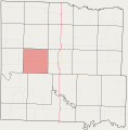 Charlotte Township, Bates County, Missouri.svg 1,310 × 1,333; 548 KB
-
 Deepwater Township, Bates County, Missouri.svg 1,310 × 1,333; 548 KB
-
 Deer Creek Township, Bates County, Missouri.svg 1,310 × 1,333; 548 KB
-
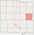
 East Boone Township, Bates County, Missouri.svg 1,310 × 1,333; 548 KB
-
 Elkhart Township, Bates County, Missouri.svg 1,310 × 1,333; 548 KB
-
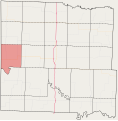
 Grand River Township, Bates County, Missouri.svg 1,310 × 1,333; 548 KB
-
 Homer Township, Bates County, Missouri.svg 1,310 × 1,333; 548 KB
-
 Howard Township, Bates County, Missouri.svg 1,310 × 1,333; 548 KB
-
 Hudson Township, Bates County, Missouri.svg 1,310 × 1,333; 548 KB
-
 Kansas City, MO.png 1,184 × 766; 423 KB
-
 Lone Oak Township, Bates County, Missouri.svg 1,310 × 1,333; 548 KB
-
 Mingo Township, Bates County, Missouri.svg 1,310 × 1,333; 548 KB
-
 Missouri 152 map changed.png 1,340 × 305; 921 KB
-
 Missouri route 109 map.png 375 × 550; 247 KB
-
 Missouri Route 115 map.png 542 × 392; 394 KB
-
 Missouri Route 141 map.png 502 × 496; 483 KB
-
 Missouri route 152 map 3.png 686 × 183; 93 KB
-
 Missouri route 163 highway map.png 511 × 552; 216 KB
-
 Missouri Route 179 map.png 643 × 577; 324 KB
-
 Missouri Route 180 map.png 1,158 × 723; 1.51 MB
-
 Missouri Route 231 map.png 673 × 562; 562 KB
-
 Missouri route 291 map 2.png 577 × 797; 551 KB
-
 Missouri Route 340 map.png 852 × 522; 758 KB
-
 Missouri Route 364 map.png 1,408 × 585; 1.33 MB
-
 Missouri route 371 map.png 624 × 682; 355 KB
-
 Missouri route 465 DECOMISSIONED HIGHWAY map.png 496 × 436; 222 KB
-
 Missouri route 81 map.png 665 × 546; 203 KB
-
 Missouri route 85 map.png 360 × 310; 48 KB
-
 Missouri route 86 map.png 951 × 586; 467 KB
-
 Missouri route 89 and missouri route 89 spur map.png 296 × 491; 79 KB
-
 Missouri route 92 map.png 1,426 × 503; 604 KB
-
 Missouri route 94 map.png 1,214 × 476; 652 KB
-
 Mo route 87 map.png 612 × 667; 392 KB
-
 Mound Township, Bates County, Missouri.svg 1,310 × 1,333; 548 KB
-
 Mount Pleasant Township, Bates County, Missouri.svg 1,310 × 1,333; 548 KB
-
 New Home Township, Bates County, Missouri.svg 1,310 × 1,333; 548 KB
-
 Osage Township, Bates County, Missouri.svg 1,310 × 1,333; 548 KB
-
 Pleasant Gap Township, Bates County, Missouri.svg 1,310 × 1,333; 548 KB
-
 Prairie Township, Bates County, Missouri.svg 1,310 × 1,333; 548 KB
-
 Rockville Township, Bates County, Missouri.svg 1,310 × 1,333; 548 KB
-
 Shawnee Township, Bates County, Missouri.svg 1,310 × 1,333; 548 KB
-
 Spruce Township, Bates County, Missouri.svg 1,310 × 1,333; 548 KB
-
 Summit Township, Bates County, Missouri.svg 1,310 × 1,333; 548 KB
-
 Walnut Township, Bates County, Missouri.svg 1,310 × 1,333; 548 KB
-
 West Boone Township, Bates County, Missouri.svg 1,310 × 1,333; 548 KB
-
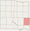
 West Point Township, Bates County, Missouri.svg 1,310 × 1,333; 548 KB


