Category:OpenStreetMap maps of Merseyside
Jump to navigation
Jump to search
Subcategories
This category has only the following subcategory.
L
- OpenStreetMap maps of Liverpool (18 F)
Media in category "OpenStreetMap maps of Merseyside"
The following 11 files are in this category, out of 11 total.
-
 A5758 road option5.jpg 1,207 × 713; 280 KB
-
 A5758 route.png 1,208 × 666; 226 KB
-
 Birkenhead Docks - OSM.jpg 1,262 × 803; 980 KB
-
 Birkenhead Heritage Tramway - OpenStreetMap.png 1,280 × 512; 337 KB
-
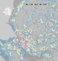 Liverpool City Region population density map, 2011 census.png 3,638 × 3,792; 10.58 MB
-
 Location map United Kingdom Southport Central.svg 304 × 250; 986 KB
-
 Location map United Kingdom Southport.svg 1,094 × 1,228; 3.69 MB
-
 Map showing the boundaries of Eccleston Civil Parish..jpg 965 × 1,794; 511 KB
-
 River Mersey map.png 1,403 × 571; 1.18 MB
-
 Southport Pier OpenStreetMap.png 1,024 × 768; 355 KB
-
 Switchisland map2017.png 986 × 777; 156 KB


