Category:OpenStreetMap maps of Mecklenburg-Vorpommern
Jump to navigation
Jump to search
Federal states of Germany:
Subcategories
This category has only the following subcategory.
S
- OpenStreetMap maps of Stralsund (19 F)
Media in category "OpenStreetMap maps of Mecklenburg-Vorpommern"
The following 18 files are in this category, out of 18 total.
-
 Altbergbau in Mecklenburg.jpg 1,563 × 678; 1.14 MB
-
 Bahnstrecke Bützow-Stettin (deutsch).png 2,500 × 970; 709 KB
-
 Bahnstrecke Bützow-Stettin (int.).png 2,500 × 974; 707 KB
-
 Bahnstrecken auf der Insel Usedom (Karte).png 1,768 × 1,786; 716 KB
-
 Boizenburger Frachtweg.png 137 × 556; 119 KB
-
 Demmin Stadtplan.PNG 723 × 511; 96 KB
-
 Dänische Wiek und Greifswald.png 1,123 × 617; 275 KB
-
 Greifswald OSM street map.png 675 × 707; 187 KB
-
 Greifswald.png 1,969 × 1,501; 1.26 MB
-
 Karte der Bahnstrecke Wolgast–Heringsdorf–Ducherow.png 1,769 × 1,381; 638 KB
-
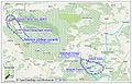
 Lage-Saline-Conow.png 807 × 537; 297 KB
-
 Lubmin Karte.png 797 × 568; 151 KB
-
 Private Maps Germany northeast.png 1,179 × 2,556; 2.7 MB
-
 Rieck at Koserow.svg 1,134 × 1,283; 1.5 MB
-
 Salzstöcke-Lübtheen-Conow-W.jpg 1,200 × 767; 631 KB
-
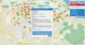 Screenshot Klarschiff HGW (alte UI).png 1,920 × 1,032; 1.17 MB
-
 Screenshot Klarschiff HRO.png 1,920 × 1,032; 1.11 MB
-
 Пролив Пенештром и город Вольгаст.png 935 × 1,355; 699 KB

.png)


.png)


.png)
.png)