Category:OpenStreetMap maps of Marche
Jump to navigation
Jump to search
- Regions of Italy: Abruzzo · Aosta Valley · Apulia · Basilicata · Calabria · Campania · Emilia-Romagna · Friuli-Venezia Giulia · Lazio · Liguria · Lombardy · Marche · Piedmont · Sicily · Trentino-South Tyrol · Tuscany · Umbria · Veneto
Media in category "OpenStreetMap maps of Marche"
The following 14 files are in this category, out of 14 total.
-
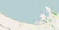 Golfo di Ancona - da OpenStreetMap 20090205.jpg 1,282 × 655; 65 KB
-
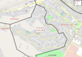 Ancona - Mappa del rione Scrima.png 2,146 × 1,511; 1.02 MB
-
 Ascoli Piceno OSM.png 937 × 617; 634 KB
-
 Fermo, localizzazione di San Domenico.png 1,616 × 1,362; 1.09 MB
-
 Ferrovia Ancona-Ancona Marittima.svg 659 × 521; 4.5 MB
-
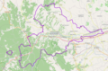
 Ferrovia Ascoli Piceno-San Benedetto del Tronto.svg 861 × 633; 10.77 MB
-
 Ferrovia Civitanova Marche-Fabriano.svg 981 × 827; 20.49 MB
-
 Italia - mappa strada statale 78.svg 1,448 × 1,359; 2.92 MB
-
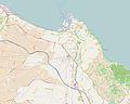 Location map Ancona.jpg 2,177 × 1,735; 554 KB
-
 Lorette (Italie) OSM 01.png 1,618 × 1,116; 1.93 MB
-
 Lorette (Italie) OSM 02.png 1,618 × 1,116; 3.32 MB
-
 Lorette (Italie) OSM 03.png 1,404 × 1,116; 1.54 MB
-
 Mapa de osimo.png 282 × 238; 17 KB
-
 Mappa ferrovia Fano-Urbino.png 801 × 551; 184 KB


_OSM_01.png)
_OSM_02.png)
_OSM_03.png)

