Category:OpenStreetMap maps of Limburg, Netherlands
Jump to navigation
Jump to search
Provinces of the Netherlands: Drenthe · Flevoland · Friesland · Gelderland · Groningen · Limburg · North Brabant · North Holland · Overijssel · South Holland · Utrecht · Zeeland
Subcategories
This category has only the following subcategory.
M
Media in category "OpenStreetMap maps of Limburg, Netherlands"
The following 59 files are in this category, out of 59 total.
-
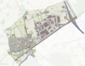
 Rijnbeek Venlo kaart map.jpg 828 × 768; 238 KB
-
 20240207OSMGerendal.png 483 × 394; 227 KB
-
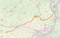
 A74 osm.PNG 551 × 619; 146 KB
-
 Abeek kaart OSM.png 1,023 × 649; 913 KB
-
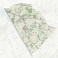
 Altweerterheidemap.png 1,998 × 1,204; 4.58 MB
-
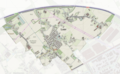
 Altweerterheidemap1.png 2,016 × 1,086; 4.29 MB
-
 Baexemmap.png 1,290 × 840; 2.11 MB
-
 Biestmap.png 756 × 694; 1.07 MB
-
 Blerickse Landweer Groot Boller Q92.jpg 1,200 × 1,000; 500 KB
-
 Boshovenmap.png 1,458 × 1,230; 3.37 MB
-
 Drielandentrein.png 1,503 × 1,090; 2.51 MB
-
 Elektriciteitsopwekking Limburg.jpg 502 × 1,264; 171 KB
-
 Ellmap.png 1,550 × 1,184; 3.4 MB
-
 Everlose Beek tracé Noordervaart Q94.jpg 1,080 × 772; 620 KB
-
 Fliegerhorst Venlo Map 1944.jpg 1,312 × 1,424; 659 KB
-
 Graswinkelmap.png 860 × 950; 582 KB
-
 Grathemmap.png 1,054 × 1,200; 2.06 MB
-
 Groenewoudmap.png 768 × 982; 1.37 MB
-
 Halermap.png 1,312 × 1,078; 2.5 MB
-
 Heythuysenmap.png 674 × 922; 1.24 MB
-
 Hunselmap.png 1,362 × 1,050; 2.62 MB
-
 Ittervoortmap.png 1,674 × 1,292; 3.7 MB
-
 Jeker-Geer kaart-map OSM.png 1,015 × 640; 901 KB
-
 Kampershoekmap.png 890 × 858; 1.37 MB
-
 Kelpen-Olermap.png 1,088 × 1,082; 2.26 MB
-
 Laarmap.png 838 × 516; 861 KB
-
 Laarveldmap.png 1,038 × 652; 1.29 MB
-
 Leukenmap.png 1,428 × 932; 2.26 MB
-
 Leveroymap.png 1,668 × 1,038; 3.09 MB
-
 Limburg Reindersmeer OSM.jpg 772 × 686; 154 KB
-
 Maasduinen-natuur-OpenTopo.jpg 6,275 × 8,514; 21.34 MB
-
 Maasplassen.jpg 965 × 709; 108 KB
-
 Map of stream Siebersbeek.jpg 800 × 736; 283 KB
-
 Map of stream Tasbeek.jpg 1,036 × 800; 426 KB
-
 Meinweg-natuur-OpenTopo.jpg 2,973 × 2,814; 3.73 MB
-
 Moeselmap.png 1,530 × 1,180; 3.52 MB
-
 Nederweerteindmap.png 1,182 × 1,018; 2.16 MB
-
 Nederweertmap.png 1,274 × 1,058; 2.57 MB
-
 Neerittermap.png 1,558 × 1,142; 3.2 MB
-
 NieuwstraatRAF2.jpg 435 × 288; 14 KB
-
 OSM - provincie Limburg.PNG 1,400 × 2,858; 3.73 MB
-
 OSM oude akerweg gasthuis-scheulder.png 1,658 × 782; 613 KB
-
 OSM oude akerweg maastricht-aken.png 1,246 × 482; 844 KB
-
 OSM oude akerweg partij-Vijlen.png 1,401 × 780; 501 KB
-
 OSM oude akerweg scheulder-partij.png 1,662 × 786; 684 KB
-
 OSM oude akerweg vijlen-vaals.png 1,664 × 787; 745 KB
-
 Ospelmap.png 1,278 × 1,114; 2.66 MB
-
 Pietersberg-natuur-OpenTopo.jpg 1,328 × 1,420; 945 KB
-
 Saarbroek on OpenStreetMap 2020.jpg 800 × 976; 275 KB
-
 Schelkensbeek.jpg 500 × 500; 168 KB
-
 Stramproymap.png 2,016 × 894; 3.39 MB
-
 Swartbroekmap.png 772 × 780; 1.22 MB
-
 Tungelroymap.png 920 × 758; 1.34 MB
-
 Tungelroymap2.png 920 × 758; 1.34 MB
-
 Tungelroymap3.png 1,236 × 1,040; 2.41 MB
-
 Valkenburg-kaart bunkers Heidegroeve.png 1,963 × 894; 734 KB
-
 Venlo-centrum-OpenTopo.jpg 3,470 × 4,240; 4.78 MB
-
 Venlo-Kwietheuvel.png 1,094 × 785; 648 KB
-
 Weertmap.png 1,604 × 908; 2.91 MB


