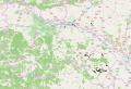
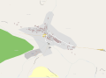
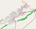
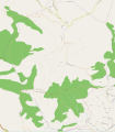
Category:OpenStreetMap maps of La Rioja (Spain)
Jump to navigation
Jump to search
Autonomous communities of Spain: Aragon · Asturias · Balearic Islands · Basque Autonomous Community · Canary Islands · Castile and León · Catalonia · Galicia · Navarre · La Rioja · Valencian Community · Autonomous cities:
Media in category "OpenStreetMap maps of La Rioja (Spain)"
The following 18 files are in this category, out of 18 total.
-
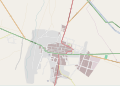
 La Rioja (Spain) - OSM Mapnik.svg 3,026 × 2,059; 15.94 MB
-
 Ambas Aguas (La Rioja, Spain) - OSM Mapnik.svg 2,876 × 2,115; 1.25 MB
-
 Arnedo (La Rioja, Spain) - OSM Mapnik.svg 2,760 × 2,264; 3.42 MB
-
 Calahorra (La Rioja, Spain) - OSM Mapnik.svg 2,548 × 2,411; 4.15 MB
-
 Cornago (La Rioja, Spain) - OSM Mapnik.svg 2,548 × 2,403; 1.2 MB
-
 Haro (La Rioja, Spain) - OSM Mapnik.svg 2,644 × 2,353; 2.22 MB
-
 Lardero (La Rioja, Spain) - OSM Mapnik.svg 2,518 × 2,423; 2.09 MB
-
 Logroño (La Rioja, Spain) - OSM Mapnik.svg 3,659 × 1,654; 12.62 MB
-
 Muro de Aguas (La Rioja, Spain) - OSM Mapnik.svg 3,146 × 1,986; 7.03 MB
-
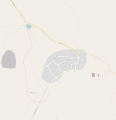
 Muro de Aguas streets (La Rioja, Spain) - OSM Mapnik.svg 2,629 × 2,334; 2.23 MB
-
 Préjano (La Rioja, Spain) - OSM Mapnik.svg 2,343 × 2,668; 2.73 MB
-
 Préjano streets (La Rioja, Spain) - OSM Mapnik.svg 1,979 × 1,404; 1,020 KB
-
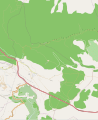
 Rioja Baja - OSM Mapnik.svg 2,504 × 2,466; 8.99 MB
-
 Santo Domingo de la Calzada (La Rioja, Spain) - OSM Mapnik.svg 2,950 × 2,104; 897 KB
-
 Varea (Logroño, La Rioja, Spain) - OSM Mapnik.svg 2,449 × 2,511; 1.12 MB
-
 Varea.png 818 × 762; 108 KB
-
 Villarroya (La Rioja, Spain) - OSM Mapnik.svg 2,193 × 2,680; 1.83 MB
-
 Villarroya streets (La Rioja, Spain) - OSM Mapnik.svg 2,450 × 2,541; 426 KB
_-_OSM_Mapnik.svg)
_-_OSM_Mapnik.svg)
_-_OSM_Mapnik.svg)
_-_OSM_Mapnik.svg)
_-_OSM_Mapnik.svg)
_-_OSM_Mapnik.svg)
_-_OSM_Mapnik.svg)
_-_OSM_Mapnik.svg)
_-_OSM_Mapnik.svg)
_-_OSM_Mapnik.svg)
_-_OSM_Mapnik.svg)
_-_OSM_Mapnik.svg)

_-_OSM_Mapnik.svg)
_-_OSM_Mapnik.svg)

_-_OSM_Mapnik.svg)
_-_OSM_Mapnik.svg)