Category:OpenStreetMap maps of Karlsruhe
Jump to navigation
Jump to search
Urban districts (cities): Freiburg · Heilbronn · Karlsruhe · Mannheim · Stuttgart ·
Media in category "OpenStreetMap maps of Karlsruhe"
The following 17 files are in this category, out of 17 total.
-
 AD Karlsruhe map.png 817 × 612; 619 KB
-
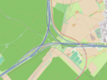 Autobahndreieck Karlsruhe der A8 mit der A5.png 1,520 × 1,136; 674 KB
-
 Entwicklung Eisenbahnnetz Karlsruhe.png 1,574 × 1,128; 1.72 MB
-
 Housenumber-karlsruhe-de-OSM.png 350 × 270; 29 KB
-
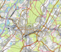
 Karlsruhe OpenStreetMap PNG.png 843 × 473; 638 KB
-
 Karlsruhe OSM 01.png 547 × 474; 284 KB
-
 Karlsruhe OSM 02.png 775 × 673; 657 KB
-
 Karlsruhe OSM 03.png 775 × 673; 455 KB
-
 Karlsruhe-Veranstaltungszentren.png 833 × 524; 688 KB
-
 Karlsruhe.png 994 × 511; 148 KB
-
 Karte Landgraben.svg 1,749 × 872; 1.91 MB
-
 KIT - Campus Sued.svg 1,124 × 1,146; 4.15 MB
-
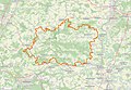 Naturpark Stromberg-Heuchelberg OSM map 2023.jpg 1,424 × 984; 1,015 KB
-
 Tram-Liniennetz VBK Stadtkreis Karlsruhe 2009.png 2,246 × 2,121; 1.95 MB
-
 Tram-Liniennetz VBK Stadtkreis Karlsruhe 2009.svg 1,078 × 1,018; 4.01 MB
-
 Transit node routing intuition.gif 500 × 479; 496 KB
-
 Veranstaltungsort WikiCon 2013.jpg 580 × 764; 99 KB


