Category:OpenStreetMap maps of Kalletal
Jump to navigation
Jump to search
Media in category "OpenStreetMap maps of Kalletal"
The following 16 files are in this category, out of 16 total.
-
 OSM - Asendorf (Kalletal).png 1,818 × 1,122; 1.88 MB
-
 OSM - Bavenhausen (Kalletal).png 1,771 × 1,101; 1.81 MB
-
 OSM - Bentorf (Kalletal).png 1,760 × 1,090; 1.96 MB
-
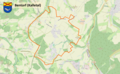
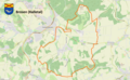 OSM - Brosen (Kalletal).png 1,806 × 1,117; 1.97 MB
-
 OSM - Erder (Kalletal).png 1,887 × 1,106; 2.14 MB
-
 OSM - Heidelbeck (Kalletal).png 1,725 × 1,069; 1.6 MB
-
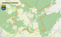
 OSM - Henstorf (Kalletal).png 1,757 × 1,092; 1.77 MB
-
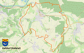
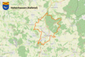 OSM - Hohenhausen (Kalletal).png 1,669 × 1,114; 2.43 MB
-
 OSM - Kalldorf.png 1,791 × 1,117; 2.01 MB
-
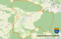 OSM - Langenholzhausen.png 1,692 × 1,090; 1.65 MB
-
 OSM - Lüdenhausen (Kalletal).png 1,782 × 1,104; 1.72 MB
-
 OSM - Osterhagen (Kalletal).png 1,761 × 1,093; 1.97 MB
-
 OSM - Stemmen (Kalletal).png 1,627 × 1,111; 1.74 MB
-
 OSM - Talle (Kalletal).png 1,758 × 1,095; 2.03 MB
-
 OSM - Varenholz.png 1,883 × 1,109; 2 MB
-
 OSM - Westorf (Kalletal).png 1,701 × 1,056; 2 MB
.png)
.png)
.png)
.png)
.png)
.png)
.png)
.png)


.png)
.png)
.png)
.png)

.png)