Category:OpenStreetMap maps of Ireland
Appearance
Subcategories
This category has the following 2 subcategories, out of 2 total.
O
- OpenStreetMap maps of Dublin (14 F)
Media in category "OpenStreetMap maps of Ireland"
The following 47 files are in this category, out of 47 total.
-
Blank Ireland OpenStreetMap.svg 235 × 303; 4 MB
-
CASL Location, from OSM, April 2012.png 909 × 747; 515 KB
-
Cobh.png 1,996 × 988; 1.04 MB
-
DBS By-election 2021 FPV by LEA.png 2,308 × 1,343; 3.16 MB
-
Dingle Way Static Map.png 600 × 751; 199 KB
-
Drogheda Municipal District.png 814 × 600; 172 KB
-
Drummully ED from Openstreetmap 2019.png 904 × 775; 245 KB
-
Fore St Feichin's ruin, map.png 1,128 × 1,530; 440 KB
-
Ireland (island).png 983 × 1,276; 442 KB
-
Kells St Colmcille's RC map.png 2,284 × 1,186; 1.34 MB
-
Kilclone townlands.png 704 × 601; 201 KB
-
Kilcloon churches map.png 1,050 × 900; 516 KB
-
Kilcloon civil parishes.png 1,050 × 900; 614 KB
-
Kilcloon GAA pitches.png 1,050 × 900; 512 KB
-
Kilcloon postal town with townlands.png 1,050 × 900; 396 KB
-
Kilcloon postal town.png 1,050 × 900; 514 KB
-
Kilcloon schools.png 1,050 × 900; 519 KB
-
Location map Ireland Athy.png 2,374 × 1,666; 2.03 MB
-
Location map Ireland Castledermot.png 1,074 × 801; 269 KB
-
Location map Ireland Clonfert.png 898 × 593; 70 KB
-
Location map Ireland Cork Central.png 2,067 × 1,611; 2.91 MB
-
Location map Ireland Ennis.png 2,054 × 1,933; 2.94 MB
-
Location map Ireland Galway.png 1,951 × 1,385; 2.28 MB
-
Location map Ireland Kildare.png 2,037 × 1,908; 1.18 MB
-
Location map Ireland Loughrea.png 1,095 × 880; 344 KB
-
Location map Ireland Tuam.png 1,298 × 1,066; 643 KB
-
Location map Ireland Youghal.png 1,663 × 1,651; 1.12 MB
-
Location map Londonderry.png 1,612 × 1,450; 1.54 MB
-
Lough Derg Station Island.png 979 × 650; 98 KB
-
Map of -27,000 historic images from Flickr Commons (8070038997).jpg 904 × 561; 63 KB
-
Map of Coolock, Dublin.png 1,845 × 972; 1.47 MB
-
Map of Mullingar, Co. Westmeath, Ireland.png 1,851 × 975; 1.07 MB
-
Map of Navan.png 1,078 × 867; 335 KB
-
Map of Ranelagh from OSM.svg 1,290 × 946; 4.53 MB
-
Marconi Railway superimposed onto OpenStreetMap map.jpg 942 × 596; 77 KB
-
OpenStreetMap Cantwells Castle Fieldnames.png 1,210 × 1,162; 301 KB
-
River Lee Ireland Map.jpg 970 × 697; 173 KB
-
River Shannon watershed.png 1,084 × 840; 1,012 KB
-
Spanish Point street map.jpg 1,394 × 1,152; 76 KB
-
Tory Island OpenStreetMaps.svg 2,963 × 1,958; 3.13 MB
-
Viking Triangle map 4.png 2,276 × 1,729; 1.06 MB
-
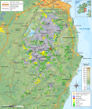
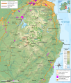
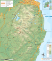
Wicklow Mountains hiking map-fr.svg 1,049 × 1,232; 3.19 MB
-
Wicklow Mountains milieux végétaux map-fr.svg 1,049 × 1,232; 3.39 MB
-
Wicklow Mountains mine map-fr.svg 1,049 × 1,232; 3.17 MB
-
Wicklow Mountains National Park map-fr.svg 1,049 × 1,232; 3.39 MB
-
Wicklow Mountains topographic map-fr.svg 1,050 × 1,234; 2.94 MB
-
Wicklow Way Map.png 600 × 751; 423 KB


