Category:OpenStreetMap maps of Hainan
Jump to navigation
Jump to search
Media in category "OpenStreetMap maps of Hainan"
The following 20 files are in this category, out of 20 total.
-
 Century Park (Haikou) map.png 1,211 × 703; 295 KB
-
 Dongzhai Harbor map - 01.jpg 1,593 × 1,814; 94 KB
-
 Dongzhai Harbor map - 02.jpg 1,593 × 1,814; 151 KB
-
 East Lake (Haikou) - map 01.png 1,196 × 564; 20 KB
-
 Evergreen Park (Haikou) - map - 01.png 478 × 408; 91 KB
-
 Guoxing Avenue map - 01.png 805 × 762; 386 KB
-
 Haikou city map - 01.png 805 × 762; 293 KB
-
 Haikou city map showing location of Haikou Century Bridge.png 805 × 762; 318 KB
-
 Haikou Tower location map - 001.png 1,095 × 574; 93 KB
-
 Location map China Hainan.png 767 × 637; 58 KB
-
 Location map Hainan.svg 766 × 508; 5.43 MB
-
 Map of Hainan - 01.png 1,402 × 1,236; 753 KB
-
 Meishe River map - 01.jpg 597 × 620; 50 KB
-
 Ocean Flower Island location map - 01.jpg 1,251 × 690; 216 KB
-
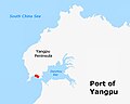 Port of Yangpu - map - 01.jpg 943 × 751; 94 KB
-
 Puqian Bridge location map - 01.png 1,337 × 710; 344 KB
-
 Sanya city map - 01.png 447 × 379; 69 KB
-
 Shapo Reservoir map - 01.png 1,244 × 1,380; 122 KB
-
 Simapo Island map - 01.png 529 × 522; 76 KB
-
 Transportation in the Haikou area 01.png 868 × 591; 261 KB
_map.png)


_-_map_01.png)
_-_map_-_01.png)


