
Category:OpenStreetMap maps of French Guiana
Media in category "OpenStreetMap maps of French Guiana"
The following 4 files are in this category, out of 4 total.
-
 France OSM H-Layer.png 3,424 × 2,872; 11.79 MB
-
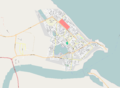 Kourou.png 2,921 × 2,131; 1.15 MB
-
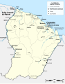 Localités de Guyane française.svg 1,116 × 1,416; 525 KB
-
 Sinnamary (fleuve) OSM.png 495 × 562; 137 KB


_OSM.png)