Category:OpenStreetMap maps of Essex
Jump to navigation
Jump to search
Media in category "OpenStreetMap maps of Essex"
The following 14 files are in this category, out of 14 total.
-
Befundskizze Kastell OTHONA, 1867-1977.png 1,081 × 856; 633 KB
-
Camp Bling map.jpg 868 × 621; 104 KB
-
Canvey Island OSM map 2010.jpg 1,062 × 818; 141 KB
-
Chelmsford North East Bypass.png 551 × 500; 97 KB
-
Epping Ongar Railway map.png 3,550 × 2,074; 7.03 MB
-
Goldhanger to Tolleshunt D'Arcy.jpg 1,148 × 887; 366 KB
-
Hamford Water.png 1,360 × 1,219; 546 KB
-
Head Street, Goldhanger, to White House Farm, Tolleshunt D'Arcy (cropped).jpg 1,124 × 809; 183 KB
-
Head Street, Goldhanger, to White House Farm, Tolleshunt D'Arcy.jpg 1,558 × 976; 1.15 MB
-
OSM map, Beacon Hill Fort, Harwich.png 805 × 702; 356 KB
-
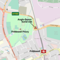
Prittlewell Anglo-Saxon burial map.png 654 × 654; 70 KB
-
ROC Posts No18Gp 1940.png 1,000 × 815; 881 KB
-
Shoeburyness boom map.png 942 × 778; 154 KB
-
SouthendOnSeaBUA.png 1,618 × 850; 1.48 MB


