
Category:OpenStreetMap maps of East Timor
Media in category "OpenStreetMap maps of East Timor"
The following 20 files are in this category, out of 20 total.
-
 Avenida Bispo Medeiros.jpg 428 × 705; 49 KB
-
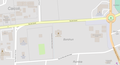
 Avenida de Motael.jpg 937 × 657; 77 KB
-
 Avenida Dom Ricardo da Silva.png 1,652 × 799; 1.36 MB
-
 Avenida Marginal.jpg 1,591 × 831; 143 KB
-
 Borohun.png 1,423 × 772; 316 KB
-
 Central Vila Verde.png 1,281 × 1,506; 499 KB
-
 Colmera und Caicoli.png 951 × 865; 742 KB
-
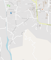
 Dare, Fatunaba and Nahaec.png 1,081 × 860; 209 KB
-
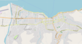 Dili map.png 1,008 × 539; 435 KB
-
 Dili OSM.jpg 9,687 × 4,290; 4.41 MB
-
 Dili OSM.png 9,687 × 4,290; 6.79 MB
-
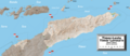 EastTimor2022OSM.png 5,876 × 2,535; 11.09 MB
-
 Map of Balide.png 1,357 × 562; 392 KB
-
 Mascarenhas.png 1,413 × 1,512; 587 KB
-
 North West Motael.jpg 1,422 × 862; 134 KB
-
 Northern Vila Verde.png 1,389 × 862; 592 KB
-
 Rumbia (Dili).jpg 1,430 × 862; 110 KB
-
 Santa Cruz (Dili).png 1,437 × 1,674; 993 KB
-
 SAPT building.png 891 × 793; 196 KB
-
 Southern Motael.png 1,346 × 1,256; 715 KB


.jpg)
.png)

