Category:OpenStreetMap maps of Chile
Jump to navigation
Jump to search
Subcategories
This category has the following 2 subcategories, out of 2 total.
Media in category "OpenStreetMap maps of Chile"
The following 67 files are in this category, out of 67 total.
-
 Accident in Chile.png 1,366 × 768; 326 KB
-
 Arbolado Urbano de Plaza Elvira Matte.png 3,507 × 2,480; 2.99 MB
-
 Avenida Mapocho.png 1,583 × 253; 487 KB
-
 Avenida Ricardo Cumming.png 524 × 721; 425 KB
-
 Canal El Carmen.png 854 × 887; 849 KB
-
 Canal Las Perdices.png 383 × 627; 274 KB
-
 Canal Mallarauco.png 1,050 × 768; 272 KB
-
 Control de autoridades.rio maipo.png 1,694 × 670; 530 KB
-
 Cuenca del lago Navarino en la isla Navarino.png 668 × 632; 724 KB
-

-
 Cuenca del lago Windhond en el centro de la isla Navarino.png 741 × 751; 915 KB
-
 Cuenca del rio Condor o rio Grande (Whiteside).png 846 × 750; 213 KB
-
 Cuenca del rio Corcovado que desemboca en el golfo Corcovado.png 593 × 784; 292 KB
-
 Cuenca del rio Pascua.png 905 × 854; 671 KB
-
 Cuenca del rio Vodudahue.png 1,134 × 851; 741 KB
-
 Cuenca del río Douglas en la parte poniente de la isla Navarino.png 745 × 904; 1.06 MB
-
 Cuenca del río Palvitad.png 563 × 509; 131 KB
-
 Cuenca del río Sapalieri.png 619 × 649; 871 KB
-
 Cuenca del río Yendegaia en isla Grande de Tierra del Fuego.png 1,076 × 878; 1.91 MB
-
 Cuenca rio serrano.svg 587 × 652; 280 KB
-
 Cuenca-hidrografica-de-la-laguna-caren.png 954 × 730; 1.16 MB
-
 Estadiozorrosdeldesiertomap.svg 1,055 × 720; 426 KB
-
 Estero Arrayán.png 525 × 748; 167 KB
-
 Estero Batuco.png 1,253 × 880; 472 KB
-
 Estero El Yali.png 368 × 557; 125 KB
-
 Estero Puangue.png 618 × 830; 251 KB
-
 Estero Quebrada de Macul.png 1,052 × 417; 455 KB
-
 Estero Quempo.png 457 × 769; 64 KB
-
 Ews-eews.gif 1,189 × 795; 41 KB
-
 Glaciares Region de OHiggins.png 1,046 × 663; 444 KB
-
 Grande Concepción.png 1,998 × 2,378; 2.65 MB
-
 Hualpén, Concepción, Chile.png 1,031 × 846; 681 KB
-
 Isla Madre de Dios map.svg 1,275 × 915; 872 KB
-
 Laguna Pineda.png 365 × 479; 303 KB
-
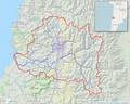 Maipo River watershed.png 989 × 792; 923 KB
-
 Mapa colegio ingles saintjohn.png 703 × 598; 126 KB
-
 Mapa de Guayacan.png 839 × 742; 262 KB
-
 Mapa de Pichilemu.svg 2,946 × 2,099; 4.14 MB
-
 Mapa de Santa Helena de Los Quinquelles de Polcura, La Ligua, Petorca, Chile.png 918 × 1,100; 549 KB
-
 Mapa Plaza de los Héroes (Rancagua).png 1,168 × 601; 205 KB
-
 Mina de cobre El Soldado y sus tranques de relave en 2024.png 1,098 × 847; 212 KB
-
 OSM Circuvalación Americo Vespucio.png 896 × 730; 957 KB
-
 OSM Lagos Aysen Chubut Cruz Magallanes.png 2,356 × 3,264; 7.28 MB
-
 OSM Parque Natural Quebrada de Macul.png 1,360 × 639; 833 KB
-
 OSM Parque natural San Carlos de Apoquindo.png 1,210 × 721; 495 KB
-
 OSM rio mapocho.png 1,003 × 680; 615 KB
-
 OSM Tierra del Fuego.png 5,564 × 2,696; 7.46 MB
-
 Parque María Behety map.jpg 351 × 269; 80 KB
-
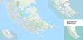
 Penisola Taitao.svg 1,124 × 714; 1.1 MB
-
 Pichilemu Openstreet.jpg 807 × 516; 68 KB
-
 Plano de Puerto Natales.png 1,007 × 880; 383 KB
-
 Plano Tongoy.jpg 1,275 × 1,048; 142 KB
-
 PN RApa NUi.png 796 × 460; 99 KB
-
 Proyecto Estadio Laguna Carén.png 851 × 537; 105 KB
-
 Puente Alto-El Volcan Railway.png 3,252 × 1,928; 1.15 MB
-
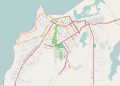
 Rancagua caminero Openstreet.png 1,167 × 569; 994 KB
-
 Mapa Calle Estado Rancagua.png 1,168 × 875; 196 KB
-
 Region de Aysen-Rios y Ciudades(png).png 778 × 1,343; 789 KB
-
 Region de Aysen-Rios y Ciudades.svg 1,000 × 1,727; 1.35 MB
-
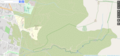
 Rio Angostura.png 1,754 × 832; 426 KB
-
 Rio San Francisco.png 1,352 × 681; 384 KB
-
 Rio Volcan.png 1,312 × 610; 147 KB
-
 Rio Yeso.png 1,349 × 700; 172 KB
-
 Río Clarillo.png 1,102 × 740; 321 KB
-
 Río Manso.png 620 × 750; 284 KB
-
 Santiago region map.png 1,784 × 1,545; 1.35 MB
-
 Serena Openstreet.png 1,287 × 570; 410 KB


_en_la_isla_Navarino.png)

.png)


.png)


.png)


