Category:OpenStreetMap maps of Buckinghamshire
Jump to navigation
Jump to search
Media in category "OpenStreetMap maps of Buckinghamshire"
The following 18 files are in this category, out of 18 total.
-
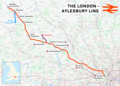 London–Aylesbury line.png 2,357 × 1,686; 3.52 MB
-
 Marlow branch line.png 1,498 × 1,838; 1.47 MB
-
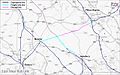
 A421 M1 Junction 13 to Milton Keynes widening scheme.png 648 × 392; 149 KB
-
 Aylesbury-Princes Risborough line.png 996 × 1,166; 653 KB
-
 A421 base.png 913 × 639; 242 KB
-
 Chepping Wycombe Urban Area.png 781 × 850; 873 KB
-
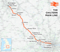 Chiltern Main Line.png 2,098 × 1,822; 4.17 MB
-
 East West Rail Consortium Central map.jpg 731 × 482; 37 KB
-
 East West Rail Consortium Eastern map.jpg 618 × 463; 43 KB
-
 East West Rail Consortium Western map.jpg 1,280 × 800; 154 KB
-
 Great train robbery map.svg 1,311 × 624; 3.7 MB
-
 Location map United Kingdom Milton Keynes.png 1,120 × 1,028; 560 KB
-
 Marston Vale line.png 2,186 × 1,946; 2.74 MB
-
 Milton Keynes Built-up Area 2011 map.png 830 × 758; 808 KB
-
 Milton Keynes population density map, 2011 census.png 3,046 × 2,455; 6.14 MB
-
 Milton Keynes Redway.gif 625 × 543; 219 KB
-
 Milton-Keynes-OpenStreetMap.png 720 × 604; 159 KB
-
 MiltonKeynes Bletchley NCR51.png 800 × 800; 505 KB


