Category:OpenStreetMap maps of Bedfordshire
Jump to navigation
Jump to search
Media in category "OpenStreetMap maps of Bedfordshire"
The following 18 files are in this category, out of 18 total.
-
 A421 base.png 913 × 639; 242 KB
-
 A421 developments.png 966 × 714; 283 KB
-
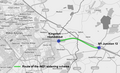 A421 M1 Junction 13 to Milton Keynes widening scheme.png 648 × 392; 149 KB
-
 Bedford tracklogs inverse.png 758 × 502; 25 KB
-
 Bedfordbase.png 740 × 636; 265 KB
-
 Bedforddevelopments.png 740 × 636; 306 KB
-
 Cranfield Bedfordshire Map.png 588 × 572; 69 KB
-
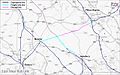
 East West Rail Consortium Eastern map.jpg 618 × 463; 43 KB
-
 East West Rail Consortium Western map.jpg 1,280 × 800; 154 KB
-
 Location map United Kingdom Bedford.png 2,115 × 1,886; 2.66 MB
-
 Luton DART map.png 894 × 555; 261 KB
-
 Luton developments.svg 1,141 × 844; 1.21 MB
-
 Luton location map.png 2,211 × 1,753; 2.95 MB
-
 Luton to Dunstable Busway route.png 708 × 464; 234 KB
-
 Luton town centre developments.png 744 × 494; 176 KB
-
 Marston Vale line.png 2,186 × 1,946; 2.74 MB
-
 Proposed Dunstable and Luton Northern Bypass.png 658 × 440; 125 KB
-
 Proposed Dunstable Northern Bypass.png 608 × 418; 101 KB


