Category:Opawskie Mountains Landscape Park
Jump to navigation
Jump to search
.jpg) | |||||
| Upload media | |||||
| Instance of | |||||
|---|---|---|---|---|---|
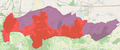
| Location | Opole Voivodeship, Poland | ||||
| IUCN protected areas category | |||||
| Inception |
| ||||
| Area |
| ||||
 | |||||
Polski: Park Krajobrazowy Góry Opawskie.
English: Opawskie Mountains Landscape Park.
Subcategories
This category has only the following subcategory.
Media in category "Opawskie Mountains Landscape Park"
The following 130 files are in this category, out of 130 total.
-
 10gwgreytui.JPG 4,592 × 2,576; 4.13 MB
-
 12dfgrhtjyi.JPG 4,592 × 2,576; 4.09 MB
-
 12ynhbtegrw.JPG 4,592 × 2,576; 3.91 MB
-
 13wrybgety.JPG 4,592 × 2,576; 4.22 MB
-
 142wrgt.JPG 4,592 × 2,576; 4.41 MB
-
 1ooo.JPG 4,592 × 2,576; 4.56 MB
-
 257df.JPG 4,592 × 2,576; 4.72 MB
-
 333o.JPG 4,592 × 2,576; 4.28 MB
-
 5etygvrfd.JPG 4,592 × 2,576; 3.28 MB
-
 6ewrthuji.JPG 4,592 × 2,576; 3.47 MB
-
 7SF DGFHG.JPG 4,592 × 2,576; 4.03 MB
-
 7ujnyhbgfv.JPG 4,592 × 2,576; 3.5 MB
-
 8ADCAFVGBRHTN.JPG 4,592 × 2,576; 3.88 MB
-
 9EQVRBTWHENMUYI,OU.JPG 4,592 × 2,576; 4.03 MB
-
 Buk w okolicach Dębowca.jpg 2,048 × 1,536; 882 KB
-
 Buk w okolicy Chocimia.jpg 2,048 × 1,536; 1.33 MB
-
 Buuu.JPG 4,592 × 2,576; 4.81 MB
-
 Dawana miejska wieża ciśnień dla Prudnika z 1893 r., Kapliczna Góra 2018.10.31 (01).jpg 4,160 × 2,336; 3.28 MB
-
 Dawana miejska wieża ciśnień dla Prudnika z 1893 r., Kapliczna Góra 2018.10.31 (02).jpg 4,160 × 2,336; 3.59 MB
-
 Dawana miejska wieża ciśnień dla Prudnika z 1893 r., Kapliczna Góra 2018.10.31 (03).jpg 4,160 × 2,336; 5.12 MB
-
 Dawana miejska wieża ciśnień dla Prudnika z 1893 r., Kapliczna Góra 2018.10.31 (06).jpg 4,160 × 2,336; 3.72 MB
-
 Dawana miejska wieża ciśnień dla Prudnika z 1893 r., Kapliczna Góra 2018.10.31 (07).jpg 4,160 × 2,336; 4.38 MB
-
 Dawana miejska wieża ciśnień dla Prudnika z 1893 r., Kapliczna Góra 2018.10.31 (08).jpg 4,160 × 2,336; 4.15 MB
-
 Dawana miejska wieża ciśnień dla Prudnika z 1893 r., Kapliczna Góra 2018.10.31 (09).jpg 4,160 × 2,336; 3.83 MB
-
 Def.JPG 4,592 × 2,576; 4.5 MB
-
 Dfegtwryhuj.JPG 4,592 × 2,576; 4.66 MB
-
 Dolina Bystrego Potoku (Pokrzywna, Jarnołtówek) 01.jpg 2,592 × 1,944; 1.7 MB
-
 Dolina Bystrego Potoku (Pokrzywna, Jarnołtówek) 02.jpg 2,592 × 1,944; 1.45 MB
-
 Dolina Bystrego Potoku (Pokrzywna, Jarnołtówek) 03.jpg 2,592 × 1,944; 1.51 MB
-
 Dolina Bystrego Potoku (Pokrzywna, Jarnołtówek) 04.jpg 2,592 × 1,944; 1.57 MB
-
 Dolina Bystrego Potoku (Pokrzywna, Jarnołtówek) 05.jpg 2,592 × 1,944; 1.54 MB
-
 Dolina Bystrego Potoku (Pokrzywna, Jarnołtówek) 06.jpg 2,592 × 1,944; 1.53 MB
-
 Dąb w Chocimiu 01.jpg 3,864 × 5,152; 6.13 MB
-
 Dąb w Chocimiu 02.jpg 3,864 × 5,152; 6.23 MB
-
 Długota, wycinka. 01.jpg 1,536 × 2,048; 1.16 MB
-
 Długota, wycinka. 02.jpg 2,048 × 1,536; 1.3 MB
-
 Długota, wycinka. 03.jpg 2,048 × 1,536; 1,010 KB
-
 Długota, wycinka. 04.jpg 2,048 × 1,536; 1.42 MB
-
 Długota, wycinka. 05.jpg 2,048 × 1,536; 1.47 MB
-
 Długota, wycinka. 06.jpg 2,048 × 1,536; 1.4 MB
-
 Efghy.JPG 4,592 × 2,576; 5.22 MB
-
 Ergthu.JPG 4,592 × 2,576; 5.16 MB
-
 Fgernhyjtmuk.JPG 4,592 × 2,576; 3.56 MB
-
 G4thuyh.JPG 4,592 × 2,576; 3.25 MB
-
 Gwarkowa Perć - las.JPG 2,136 × 2,848; 3.02 MB
-
 Gwarkowa Perć.JPG 2,848 × 2,136; 2.65 MB
-
 Góry opawskie.JPG 4,592 × 2,576; 4.84 MB
-
 Góry opawskiety.JPG 4,592 × 2,576; 2.28 MB
-
 Góry opawskietyjkio8.JPG 4,592 × 2,576; 2.13 MB
-
 Góry opawskietys.JPG 4,592 × 2,576; 2.28 MB
-
 Góry1.JPG 4,592 × 2,576; 2.28 MB
-
 Góry2.JPG 4,592 × 2,576; 2.63 MB
-
 Góry3.JPG 4,592 × 2,576; 3.03 MB
-
 Hgfdes.JPG 4,592 × 2,576; 5.31 MB
-
 Hhhhha.JPG 4,592 × 2,576; 4.84 MB
-
 Hjhgf.JPG 4,592 × 2,576; 5.22 MB
-
 Hjmtuk,utmjrnyhetbgvw.JPG 4,592 × 2,576; 3.59 MB
-
 Iifd.JPG 4,592 × 2,576; 5.16 MB
-
 Jhebgvf.JPG 4,592 × 2,576; 3.44 MB
-
 Juyhrt.JPG 4,592 × 2,576; 3.41 MB
-
 Jynhgdferwtyuy.JPG 4,592 × 2,576; 3.5 MB
-
 Kapliczna Góra, 2018.10.31.jpg 4,160 × 2,336; 4.67 MB
-
 Koba Biskupia widok 1.jpg 2,847 × 1,537; 1.49 MB
-
 Kopa Biskupia - widok 2.jpg 2,301 × 2,131; 1.28 MB
-
 Kopa otulona tęczą.JPG 4,592 × 2,576; 5.22 MB
-
 Las bukowy (okolice Dębowca(.jpg 2,048 × 1,536; 1.49 MB
-
 Las pod Kopą Biskupią.JPG 2,848 × 2,136; 1.59 MB
-
 Las Prudnicki, ruiny klasztoru kapucynów 01.jpg 1,765 × 1,535; 1.18 MB
-
 Las Prudnicki, ruiny klasztoru kapucynów 02.jpg 1,788 × 1,535; 1.18 MB
-
 Las Prudnicki, ruiny klasztoru kapucynów 03.jpg 2,048 × 1,536; 1.31 MB
-
 Las Prudnicki, ruiny klasztoru kapucynów 04.jpg 2,048 × 1,536; 1.34 MB
-
 Las Prudnicki. 01.jpg 5,152 × 3,864; 7.96 MB
-
 Las Prudnicki. 02.jpg 5,152 × 3,864; 7.94 MB
-
 Logo Parku Krajobrazowego Góry Opawskie.svg 534 × 535; 58 KB
-
 Oczko wodne pod Dębowcem 01.jpg 2,048 × 1,536; 1.8 MB
-
 Oczko wodne pod Dębowcem 02.jpg 2,048 × 1,536; 1.22 MB
-
 Opawskie Mountains Landscape Park.png 2,005 × 832; 788 KB
-
 Piekielko-skała.jpg 2,136 × 2,848; 2.13 MB
-
 Piekiełko otoczenie.JPG 2,848 × 2,136; 2.68 MB
-
 Pod Svetym Rochem.jpg 2,945 × 3,153; 3.64 MB
-
 Polana pod Kopą Biskupią.jpg 2,086 × 1,765; 1.72 MB
-
 Rgrhyuj (Czapka).JPG 2,255 × 1,539; 1.19 MB
-
 Rgrhyuj.JPG 4,592 × 2,576; 5.31 MB
-
 Rtgh.JPG 4,592 × 2,576; 4.69 MB
-
 Rthebgfvqewgryenu.JPG 4,592 × 2,576; 3.5 MB
-
 Ruiny Sanktuarium Matki Bożej Bolesnej z 1743 r., Kapliczna Góra 2018.10.31 (01).jpg 2,336 × 4,160; 3.54 MB
-
 Ruiny Sanktuarium Matki Bożej Bolesnej z 1743 r., Kapliczna Góra 2018.10.31 (03).jpg 4,160 × 2,336; 4.54 MB
-
 Ruiny Sanktuarium Matki Bożej Bolesnej z 1743 r., Kapliczna Góra 2018.10.31 (04).jpg 4,160 × 2,336; 5.3 MB
-
 Ruiny Sanktuarium Matki Bożej Bolesnej z 1743 r., Kapliczna Góra 2018.10.31 (05).jpg 2,336 × 4,160; 4.76 MB
-
 Ruiny Sanktuarium Matki Bożej Bolesnej z 1743 r., Kapliczna Góra 2018.10.31 (06).jpg 4,160 × 2,336; 3.67 MB
-
 Ruiny Sanktuarium Matki Bożej Bolesnej z 1743 r., Kapliczna Góra 2018.10.31 (07).jpg 4,160 × 2,336; 4.26 MB
-
 Ruiny Sanktuarium Matki Bożej Bolesnej z 1743 r., Kapliczna Góra 2018.10.31 (08).jpg 4,160 × 2,336; 4.16 MB
-
 Ruiny Sanktuarium Matki Bożej Bolesnej z 1743 r., Kapliczna Góra 2018.10.31 (09).jpg 4,160 × 2,336; 3.97 MB
-
 Ruiny Sanktuarium Matki Bożej Bolesnej z 1743 r., Kapliczna Góra 2018.10.31 (10).jpg 4,160 × 2,336; 4.4 MB
-
 Ruiny Sanktuarium Matki Bożej Bolesnej z 1743 r., Kapliczna Góra 2018.10.31 (11).jpg 4,160 × 2,336; 4.73 MB
-
 Ruiny Sanktuarium Matki Bożej Bolesnej z 1743 r., Kapliczna Góra 2018.10.31 (12).jpg 4,160 × 2,336; 4.27 MB
-
 Ruiny Sanktuarium Matki Bożej Bolesnej z 1743 r., Kapliczna Góra 2018.10.31 (13).jpg 4,160 × 2,336; 5.41 MB
-
 Ruiny Sanktuarium Matki Bożej Bolesnej z 1743 r., Kapliczna Góra 2018.10.31 (14).jpg 4,160 × 2,336; 4.28 MB
-
 Ruiny Sanktuarium Matki Bożej Bolesnej z 1743 r., Kapliczna Góra 2018.10.31 (15).jpg 4,160 × 2,336; 3.83 MB
-
 Ruiny Sanktuarium Matki Bożej Bolesnej z 1743 r., Kapliczna Góra 2018.10.31 (16).jpg 4,160 × 2,336; 3.71 MB
-
 Ruiny Sanktuarium Matki Bożej Bolesnej z 1743 r., Kapliczna Góra 2018.10.31 (17).jpg 4,160 × 2,336; 4.67 MB
-
 Ruiny Sanktuarium Matki Bożej Bolesnej z 1743 r., Kapliczna Góra 2018.10.31 (18).jpg 4,160 × 2,336; 5.34 MB
-
 Ruiny Sanktuarium Matki Bożej Bolesnej z 1743 r., Kapliczna Góra 2018.10.31 (19).jpg 4,160 × 2,336; 5.14 MB
-
 Ruiny Sanktuarium Matki Bożej Bolesnej z 1743 r., Kapliczna Góra 2018.10.31 (20).jpg 4,160 × 2,336; 4.52 MB
-
 Ruiny Sanktuarium Matki Bożej Bolesnej z 1743 r., Kapliczna Góra 2018.10.31 (21).jpg 4,160 × 2,336; 5.15 MB
-
 Ruiny Sanktuarium Matki Bożej Bolesnej z 1743 r., Kapliczna Góra 2018.10.31 (22).jpg 4,160 × 2,336; 5.15 MB
-
 Sdfvgrehtujy.JPG 4,592 × 2,576; 3.78 MB
-
 Stawy w Wieszczynie 01.jpg 2,048 × 1,536; 898 KB
-
 Stawy w Wieszczynie 02.jpg 2,048 × 1,536; 803 KB
-
 Tjyrhtebgvw.JPG 4,592 × 2,576; 5.06 MB
-
 U6hygtrefqrtrytu.JPG 4,592 × 2,576; 3.53 MB
-
 Ujnyhtebgfvwecq.JPG 4,592 × 2,576; 3.53 MB
-
 Ukmtnrh.JPG 4,592 × 2,576; 5.75 MB
-
 Uyjhbgfv.JPG 4,592 × 2,576; 3.44 MB
-
 Wdcfeth.JPG 4,592 × 2,576; 5.91 MB
-
 Wiatrołomy.jpg 5,152 × 3,864; 17.51 MB
-
 Widok na z Kopy Biskupiej m. Jarnołtówek.JPG 3,264 × 2,448; 2.91 MB
-
 Widok na z Kopy Biskupiej m. Zlate Hory.JPG 3,264 × 2,448; 2.88 MB
-
 Widok na z Kopy Biskupiej na stronę czeską w kierunku szczytu Pradziad.JPG 3,264 × 2,448; 2.84 MB
-
 Widok z podnóża Kaplicznej Góry, 2018.10.31 (01).jpg 4,160 × 2,336; 5.13 MB
-
 Ymujrnyethbw.JPG 4,592 × 2,576; 3.69 MB
-
 Łupki, Młyńka Góra, Moszczanka 01.jpg 1,973 × 1,535; 1.18 MB
-
 Łupki, Młyńka Góra, Moszczanka 02.jpg 1,534 × 1,742; 1.05 MB
-
 Łupki, Młyńka Góra, Moszczanka 03.jpg 1,513 × 1,742; 609 KB
-
 Ścieżka przyrodniczo-dydaktyczna Las Prudnicki, Prudnik 2018.10.31 (01).jpg 2,336 × 4,160; 3.36 MB
-
 Ścieżka przyrodniczo-dydaktyczna Las Prudnicki, Prudnik 2018.10.31 (02).jpg 4,160 × 2,336; 5.04 MB
-
 Ścieżka przyrodniczo-dydaktyczna Las Prudnicki, Prudnik 2018.10.31 (03).jpg 4,160 × 2,336; 5.77 MB
-
 Ścieżka przyrodniczo-dydaktyczna Las Prudnicki, Prudnik 2018.10.31 (04).jpg 4,160 × 2,336; 5.15 MB
-
 Ścieżka przyrodniczo-dydaktyczna Las Prudnicki, Prudnik 2018.10.31 (05).jpg 2,336 × 3,507; 4.46 MB
-
 Ścieżka przyrodniczo-dydaktyczna Las Prudnicki, Prudnik 2018.10.31 (06).jpg 4,160 × 2,336; 5.19 MB


.jpg)
.jpg)
.jpg)
.jpg)
.jpg)
.jpg)
.jpg)


_01.jpg)
_02.jpg)
_03.jpg)
_04.jpg)
_05.jpg)
_06.jpg)


.JPG)


.jpg)
.jpg)
.jpg)
.jpg)
.jpg)
.jpg)
.jpg)
.jpg)
.jpg)
.jpg)
.jpg)
.jpg)
.jpg)
.jpg)
.jpg)
.jpg)
.jpg)
.jpg)
.jpg)
.jpg)
.jpg)


.jpg)


.jpg)
.jpg)
.jpg)
.jpg)
.jpg)