Category:Oostveenseweg 7, Schipluiden
Jump to navigation
Jump to search
| Object location | | View all coordinates using: OpenStreetMap |
|---|
.jpg) | |||||
| Upload media | |||||
| Instance of | |||||
|---|---|---|---|---|---|
| Part of | |||||
| Location | Schipluiden, South Holland, Netherlands | ||||
| Street address |
| ||||
| Heritage designation |
| ||||
 | |||||
|
This is a category about rijksmonument number 521903
|
| Address |
|
Media in category "Oostveenseweg 7, Schipluiden"
The following 5 files are in this category, out of 5 total.
-
 Schipluiden - Oostveenseweg 7 (boerderij).jpg 2,592 × 1,944; 1.66 MB
-
 Schipluiden - Oostveenseweg 7 (hek).jpg 2,592 × 1,944; 1.9 MB
-
 Schipluiden - Oostveenseweg 7 (karnschuur annex stal).jpg 1,573 × 1,979; 815 KB
-
 Schipluiden - Oostveenseweg 7 (wagenschuur).jpg 2,592 × 1,944; 1.21 MB
-
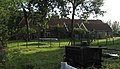 Schipluiden - Oostveenseweg 7.jpg 2,312 × 1,324; 1,020 KB
.jpg)
.jpg)
.jpg)
