Category:Oosthaven 56, Gouda
Jump to navigation
Jump to search
| Object location | | View all coordinates using: OpenStreetMap |
|---|
 | |||||
| Upload media | |||||
| Instance of |
| ||||
|---|---|---|---|---|---|
| Location | Gouda, South Holland, Netherlands | ||||
| Street address |
| ||||
| Located on street | |||||
| Heritage designation |
| ||||
 | |||||
|
This is a category about rijksmonument number 16897
|
| Address |
|
Media in category "Oosthaven 56, Gouda"
The following 52 files are in this category, out of 52 total.
-
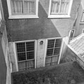 Achtergevel - Gouda - 20082690 - RCE.jpg 1,192 × 1,200; 287 KB
-
 Achtergevel - Gouda - 20082691 - RCE.jpg 1,185 × 1,200; 302 KB
-
 Achtergevel - Gouda - 20082692 - RCE.jpg 1,186 × 1,200; 404 KB
-
 Beschilderde balklagen - Gouda - 20082720 - RCE.jpg 1,192 × 1,200; 332 KB
-
 Beschilderde balklagen - Gouda - 20082721 - RCE.jpg 1,181 × 1,200; 229 KB
-
 Beschilderde balklagen - Gouda - 20082722 - RCE.jpg 1,184 × 1,200; 281 KB
-
 Beschilderde balklagen - Gouda - 20082723 - RCE.jpg 1,192 × 1,200; 333 KB
-
 Beschilderde balklagen - Gouda - 20082724 - RCE.jpg 1,195 × 1,200; 301 KB
-
 Beschilderde balklagen - Gouda - 20082725 - RCE.jpg 1,192 × 1,200; 258 KB
-
 Beschilderde balklagen - Gouda - 20082726 - RCE.jpg 1,195 × 1,200; 316 KB
-
 Detail - Gouda - 20082688 - RCE.jpg 801 × 1,200; 240 KB
-
 Exterieur OVERZICHT BESCHILDERDE BALKLAAG - Gouda - 20262432 - RCE.jpg 1,200 × 797; 181 KB
-
 Exterieur OVERZICHT VOORGEVELS - Gouda - 20262430 - RCE.jpg 800 × 1,200; 185 KB
-
 Gang begane grond plafond - Gouda - 20082703 - RCE.jpg 1,200 × 1,200; 194 KB
-
 Interieur 1e etage kamer achter - Gouda - 20082718 - RCE.jpg 1,197 × 1,200; 231 KB
-
 Interieur achterkamer begane grond - Gouda - 20082696 - RCE.jpg 1,197 × 1,200; 269 KB
-
 Interieur achterkamer begane grond kast - Gouda - 20082699 - RCE.jpg 1,200 × 1,200; 284 KB
-
 Interieur achterkamer begane grond kast - Gouda - 20082700 - RCE.jpg 1,192 × 1,200; 230 KB
-
 Interieur achterkamer begane grond plafond - Gouda - 20082698 - RCE.jpg 1,200 × 1,200; 222 KB
-
 Interieur achterkamer begane grond schouw - Gouda - 20082697 - RCE.jpg 1,197 × 1,200; 173 KB
-
 Interieur detail gang begane grond - Gouda - 20082704 - RCE.jpg 1,195 × 1,200; 190 KB
-
 Interieur detail gang begane grond - Gouda - 20082705 - RCE.jpg 1,195 × 1,200; 167 KB
-
 Interieur detail gang begane grond - Gouda - 20082706 - RCE.jpg 1,200 × 1,200; 165 KB
-
 Interieur gang begane grond - Gouda - 20082701 - RCE.jpg 1,197 × 1,200; 178 KB
-
 Interieur gang begane grond plafond - Gouda - 20082702 - RCE.jpg 1,200 × 1,200; 169 KB
-
 Interieur gang met stucwerk aan wand en plafond - Gouda - 20358712 - RCE.jpg 1,195 × 1,200; 199 KB
-
 Interieur kamer 1e etage - Gouda - 20082716 - RCE.jpg 1,192 × 1,200; 320 KB
-
 Interieur kamer 1e etage plafond - Gouda - 20082717 - RCE.jpg 1,190 × 1,200; 301 KB
-
 Interieur trappenhuis - Gouda - 20082707 - RCE.jpg 1,200 × 1,197; 245 KB
-
 Interieur trappenhuis - Gouda - 20082708 - RCE.jpg 1,195 × 1,200; 207 KB
-
 Interieur trappenhuis - Gouda - 20082709 - RCE.jpg 1,195 × 1,200; 199 KB
-
 Interieur trappenhuis - Gouda - 20082710 - RCE.jpg 1,192 × 1,200; 186 KB
-
 Interieur trappenhuis - Gouda - 20082711 - RCE.jpg 1,188 × 1,200; 180 KB
-
 Interieur trappenhuis - Gouda - 20082712 - RCE.jpg 1,195 × 1,200; 171 KB
-
 Interieur trappenhuis - Gouda - 20358595 - RCE.jpg 1,200 × 1,195; 254 KB
-

-
 Interieur voorkamer 1e etage - Gouda - 20082713 - RCE.jpg 1,200 × 1,197; 230 KB
-
 Interieur voorkamer 1e etage plafond - Gouda - 20082715 - RCE.jpg 1,200 × 1,195; 252 KB
-
 Interieur voorkamer 1e etage schouw - Gouda - 20082714 - RCE.jpg 1,197 × 1,200; 306 KB
-
 Interieur voorkamer begane grond - Gouda - 20082693 - RCE.jpg 1,185 × 1,200; 200 KB
-
 Interieur voorkamer begane grond plafond - Gouda - 20082695 - RCE.jpg 1,197 × 1,200; 232 KB
-
 Interieur voorkamer begane grond schouw - Gouda - 20082694 - RCE.jpg 1,200 × 1,200; 254 KB
-
 INTERIEUR, BESCHILDERDE BALKLAAG, DETAIL - Gouda - 20262434 - RCE.jpg 1,200 × 775; 186 KB
-
 INTERIEUR, BESCHILDERDE BALKLAAG, DETAIL - Gouda - 20262435 - RCE.jpg 1,200 × 800; 203 KB
-
 INTERIEUR, BESCHILDERDE BALKLAAG, DETAIL - Gouda - 20262436 - RCE.jpg 1,200 × 771; 170 KB
-
 INTERIEUR, BESCHILDERDE BALKLAAG, DETAIL - Gouda - 20262437 - RCE.jpg 1,200 × 796; 161 KB
-
 INTERIEUR, OVERZICHT BESCHILDERDE BALKLAAG - Gouda - 20262433 - RCE.jpg 1,200 × 783; 175 KB
-
 Interieur, overzicht kamer - Gouda - 20358715 - RCE.jpg 1,192 × 1,200; 228 KB
-
 Oosthaven 56, Gouda.jpg 2,048 × 3,072; 2.72 MB
-
 Overzicht - Gouda - 20082685 - RCE.jpg 804 × 1,200; 228 KB
-
 Overzicht - Gouda - 20082687 - RCE.jpg 804 × 1,200; 241 KB
-
 Zolder interieur - Gouda - 20082719 - RCE.jpg 1,200 × 1,197; 237 KB


