Category:Oostbroek (De Bilt)
Jump to navigation
Jump to search
| Object location | | View all coordinates using: OpenStreetMap |
|---|
estate in De Bilt, the Netherlands .JPG) | |||||
| Upload media | |||||
| Instance of | |||||
|---|---|---|---|---|---|
| Part of | |||||
| Location | De Bilt, Utrecht, Netherlands | ||||
| Street address |
| ||||
| Located on street |
| ||||
| Architectural style | |||||
| Architect | |||||
| Owned by | |||||
| Heritage designation |
| ||||
 | |||||
|
This is a category about rijksmonumentcomplex number 514651
|
Landhuis:
|
This is a category about rijksmonument number 514653
|
Orangerie:
|
This is a category about rijksmonument number 514654
|
Koetshuis:
|
This is a category about rijksmonument number 529156
|
Historische aanleg:
|
This is a category about rijksmonument number 529157
|
| Address |
|
Subcategories
This category has the following 4 subcategories, out of 4 total.
Media in category "Oostbroek (De Bilt)"
The following 60 files are in this category, out of 60 total.
-
 Achtergevel - De Bilt - 20369555 - RCE.jpg 3,306 × 2,204; 1.81 MB
-
 Achtergevel - De Bilt - 20369556 - RCE.jpg 3,272 × 2,204; 1.66 MB
-
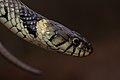 Barred grass snake (Natrix helvetica).jpg 4,750 × 3,167; 5.61 MB
-

-
 Boerderij aan de Hoofddijk, overzicht - De Bilt - 20034988 - RCE.jpg 3,060 × 3,066; 2.13 MB
-
 Boerderij aan de Hoofddijk, rechter zij- en achtergevel - De Bilt - 20034990 - RCE.jpg 3,048 × 3,048; 2.36 MB
-
 Boerderij overzicht aan de Hoofddijk - De Bilt - 20034989 - RCE.jpg 3,048 × 3,042; 1.8 MB
-
 Boerderijtje, achter- en Linkerzijgevel Bunnikseweg 47 - De Bilt - 20034994 - RCE.jpg 3,054 × 3,072; 2.57 MB
-
 Boerderijtje, Bunnikseweg 47, voor- en rechter zijgevel - De Bilt - 20034993 - RCE.jpg 3,048 × 3,054; 3.13 MB
-
 De Bilt - Oostbroek - park - autumn 2018 (43518093840).jpg 2,560 × 1,707; 2.96 MB
-
 De Bilt - Oostbroek - park - bridge (40374440562).jpg 6,000 × 4,000; 10.13 MB
-
 De Bilt, Oostbroek hist parkaanleg RM514652.jpg 3,697 × 2,800; 10.18 MB
-
 De hoogste gewone es van Nederland, 39.5 meter hoog.jpg 5,184 × 3,456; 21.57 MB
-
 De Mathildebrug dient als verhoogd wandelpad door het broekbos.jpg 5,184 × 3,456; 17.94 MB
-
 Een deel van het onbeheerde broekbos.jpg 5,184 × 3,456; 17.53 MB
-
 Een familie grauwe ganzen in het grasland van Oostbroek.jpg 5,184 × 3,456; 12.27 MB
-
 Een fruitboomgaard in Landgoed Oostbroek.jpg 5,184 × 3,456; 12.47 MB
-
 Een meerkikker in de meander langs het broekbos.jpg 5,184 × 3,456; 9.71 MB
-
 Een ree in het grasland voor het landhuis.jpg 4,345 × 2,897; 8.5 MB
-
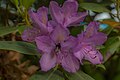
 Een rododendron in de buurt van het landhuis.jpg 5,184 × 3,456; 10.26 MB
-
 Een rododendron wordt bestoven door een hommel.jpg 5,184 × 3,456; 9.95 MB
-
 Een stuk van het onbeheerde broekbos.jpg 5,184 × 3,456; 17.31 MB
-
 Een van de fruitboomgaarden.jpg 5,184 × 3,456; 17.42 MB
-
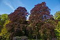 Een van de rode beuken rondom het landhuis.jpg 5,184 × 3,456; 15.15 MB
-
 Een waterweg langs het broekbos.jpg 5,184 × 3,456; 16.39 MB
-
 Een weiland in het verpachte noordelijke gedeelte.jpg 5,004 × 3,336; 12.63 MB
-
 Haarlems klokkenspel.jpg 4,180 × 2,787; 4.94 MB
-
 Het wandelpad over de dijk in het noordelijke gedeelte.jpg 5,184 × 3,456; 19.98 MB
-
 Hoofdgebouw, achteraanzicht - De Bilt - 20034976 - RCE.jpg 3,042 × 3,060; 3.71 MB
-
 Hoofdgebouw, achtergevel - De Bilt - 20034977 - RCE.jpg 3,048 × 3,060; 4.13 MB
-
 Hoofdgebouw, voorgevel - De Bilt - 20034974 - RCE.jpg 3,060 × 3,042; 3.88 MB
-
 HUA-107433-Plattegrond van de landerijen en tuinen rond het huis Oostbroek bij De Bilt.jpg 3,929 × 2,539; 1.82 MB
-

-

-
 HUA-201716-Gezicht over een weiland op de voorgevel van het huis Oostbroek bij De Bilt.jpg 3,257 × 2,046; 1.69 MB
-

-
 HUA-201719-Gezicht in het park van het landgoed Oostbroek bij De Bilt.jpg 1,518 × 910; 282 KB
-

-

-

-

-
 Huis Bunnikseweg 33 - De Bilt - 20034992 - RCE.jpg 3,048 × 3,042; 3.37 MB
-
 Huis Bunnikseweg 53, voor- en linkerzijgevel - De Bilt - 20034995 - RCE.jpg 3,060 × 3,072; 3.96 MB
-
 Huis Bunniksweweg 53, achter- en linker zijgevel - De Bilt - 20034996 - RCE.jpg 3,048 × 3,066; 2.65 MB
-
 Huizen aan de Bunnikseweg 33-39A - De Bilt - 20034991 - RCE.jpg 3,018 × 3,042; 3.26 MB
-
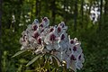
 In de omgeving van het landhuis staan verschillende rododendrons.jpg 5,184 × 3,456; 16.74 MB
-
-
 In het broekbos kunnen dode bomen blijven staan.jpg 5,184 × 3,456; 22.14 MB
-

-
 Inrijhek Bunnikseweg - De Bilt - 20034970 - RCE.jpg 3,054 × 3,060; 4.8 MB
-
 Kaart uit 1648 met percelen van de voormalige abdij Oostbroek te De Bilt.jpg 1,400 × 995; 421 KB
-
 Oostbroek-De Bilt (6).JPG 3,006 × 1,998; 1.44 MB
-
 Oostbroek-De Bilt (9).JPG 2,948 × 1,906; 1.68 MB
-
 Oostbroek.jpg 2,106 × 1,470; 624 KB
-
 Overzicht hoofdgebouw achteraanzicht en situatie - De Bilt - 20034975 - RCE.jpg 3,060 × 3,048; 2.6 MB
-
 Overzicht hoofdgebouw voorgevel - De Bilt - 20034973 - RCE.jpg 3,042 × 3,066; 2.28 MB
-
 Overzicht park met achtergevel - De Bilt - 20369554 - RCE.jpg 3,275 × 2,204; 1.47 MB
-
 Schuur ten rechterzijde van hoofdgebouw - De Bilt - 20034978 - RCE.jpg 3,054 × 3,048; 2.15 MB
-
 Tuin - De Bilt - 20034971 - RCE.jpg 3,036 × 3,078; 2.15 MB
-
 Tuin - De Bilt - 20034972 - RCE.jpg 3,054 × 3,048; 1.93 MB


.jpg)


.jpg)
.jpg)


.JPG)


