Category:Ondermolen K
Jump to navigation
Jump to search
| Object location | | View all coordinates using: OpenStreetMap |
|---|
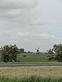
windmill in Schermerhorn, Netherlands  | |||||
| Upload media | |||||
| Instance of |
| ||||
|---|---|---|---|---|---|
| Part of | |||||
| Location | Schermerhorn, Alkmaar, North Holland, Netherlands | ||||
| Street address |
| ||||
| Located on street |
| ||||
| Has use |
| ||||
| Heritage designation |
| ||||
| Source of energy | |||||
 | |||||
|
This is a category about rijksmonument number 33103
|
| Address |
|
Media in category "Ondermolen K"
The following 11 files are in this category, out of 11 total.
-
 Ondermolen "K", (Schermerdijk noord-zijde 4) - Schermerhorn - 20195730 - RCE.jpg 1,200 × 1,173; 280 KB
-
 Ondermolen "K", molemakershuis exterieur - Schermerhorn - 20195726 - RCE.jpg 1,200 × 1,172; 365 KB
-
 Ondermolen "K", molemakershuis exterieur - Schermerhorn - 20195727 - RCE.jpg 1,200 × 1,177; 337 KB
-
 Ondermolen "K", molemakershuis exterieur - Schermerhorn - 20195728 - RCE.jpg 1,200 × 1,170; 336 KB
-
 Ondermolen "K", molemakershuis exterieur - Schermerhorn - 20195729 - RCE.jpg 1,200 × 1,179; 376 KB
-
 Ondermolen "K", molemakershuis interieur - Schermerhorn - 20195725 - RCE.jpg 1,200 × 1,168; 222 KB
-
 Ondermolen K - panoramio.jpg 2,736 × 3,648; 3.35 MB
-
 Schermerhorn - Ondermolen K met zeilen.jpg 1,600 × 1,600; 1.36 MB
-

-
 Vergezicht met Bovenmolen G, links de Ondermolen K - Schermerhorn - 20364351 - RCE.jpg 1,200 × 1,195; 197 KB
-

_-_Schermerhorn_-_20195730_-_RCE.jpg)


