Category:Olland
Jump to navigation
Jump to search
| Object location | | View all coordinates using: OpenStreetMap |
|---|
village in Meierijstad, the Netherlands    | |||||
| Upload media | |||||
| Instance of | |||||
|---|---|---|---|---|---|
| Location |
| ||||
 | |||||
Subcategories
This category has only the following subcategory.
1
Media in category "Olland"
The following 12 files are in this category, out of 12 total.
-
 Map - NL - Sint-Oedenrode - Wijk 03 Olland - Buurt 00 Olland.svg 375 × 375; 22 KB
-

-
 Map - NL - Sint-Oedenrode - Wijk 03 Olland.svg 625 × 575; 9 KB
-
 Achter- en zijgevel nr. 7440 - Olland - 20504417 - RCE.jpg 1,200 × 900; 162 KB
-
 Boelaarshoeve.jpg 800 × 600; 203 KB
-
 Martinus kerk Olland.jpg 2,016 × 1,512; 1.9 MB
-
 MFA deLoopr.jpg 2,016 × 1,512; 1.5 MB
-
 Olland Netherlands.jpg 412 × 259; 18 KB
-

-

-
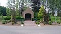 Petrus kapel.jpg 1,920 × 1,080; 1.11 MB
-
 Zonsondergang.jpg 944 × 681; 161 KB


