Category:Oliver Street (Boston)
Jump to navigation
Jump to search
| Object location | | View all coordinates using: OpenStreetMap |
|---|
Subcategories
This category has the following 3 subcategories, out of 3 total.
Media in category "Oliver Street (Boston)"
The following 14 files are in this category, out of 14 total.
-
 1814 FinancialDistrict Boston map Hales.png 805 × 714; 1.11 MB
-
 1872 OliverSt MilkSt Boston 2351573942.jpg 642 × 651; 200 KB
-
 1899 BroadSt Boston map byAEDowns BPL.png 808 × 714; 1.34 MB
-
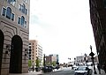
 2008 100 OliverSt Boston 2225634231.jpg 350 × 405; 49 KB
-
 2010 OliverSt Boston.jpg 2,736 × 3,648; 3.71 MB
-
 2010 OliverSt Boston2.jpg 3,610 × 2,686; 3.45 MB
-
 2010 OliverSt SeaportBlvd Boston.jpg 3,403 × 2,417; 1.96 MB
-
 2010 OliverSt SeaportBlvd Boston2.jpg 2,572 × 3,523; 1.54 MB
-
 2010 OliverSt SeaportBlvd Boston3.jpg 3,648 × 2,736; 3.79 MB
-
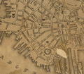 Financial Boston1829 Stimpson.png 809 × 711; 1.17 MB
-
 HighSt OliverSt ca1870 Boston.png 796 × 508; 521 KB
-
 Journal of the Association of Engineering Societies (1903) (14597004059).jpg 2,816 × 1,638; 1.35 MB
-
 PhotoElectrotype OliverSt StrangersGuideToBoston 1883.png 365 × 475; 112 KB
-
 Prebigdig.jpg 1,024 × 1,280; 340 KB


_(14597004059).jpg)

