Category:Old topographic maps of Tarn
Jump to navigation
Jump to search
Media in category "Old topographic maps of Tarn"
The following 7 files are in this category, out of 7 total.
-
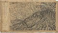
 Carte d'État-major de la France, Feuille Bédarieux N.O.jpg 23,386 × 13,717; 126.53 MB
-
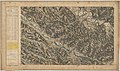
 Carte d'État-major de la France, Feuille Castres N.E.jpg 23,622 × 13,739; 129.55 MB
-
 Carte d'État-major de la France, Feuille Castres N.O.jpg 23,622 × 13,699; 126.61 MB
-
 Carte d'État-major de la France, Feuille Castres S.E.jpg 23,622 × 13,694; 124.8 MB
-
 Carte d'État-major de la France, Feuille Castres S.O.jpg 23,622 × 13,770; 120.1 MB
-
 Carte d'État-major de la France, Feuille Toulouse N.E.jpg 24,165 × 14,306; 131.08 MB
-
 Carte d'État-major de la France, Feuille Toulouse S.E.jpg 24,142 × 14,427; 128.95 MB


