Category:Old topographic maps of Germany
Jump to navigation
Jump to search
Subcategories
This category has only the following subcategory.
Media in category "Old topographic maps of Germany"
The following 48 files are in this category, out of 48 total.
-

-
 Map of pre World War II Germany TK25 Hemelingen 2919.jpg 9,688 × 7,784; 20.5 MB
-
 St.Jürgen Asyl 1944.png 1,890 × 1,486; 5.39 MB
-
 5103Eschweiler1910Kopie.jpg 2,953 × 3,098; 4.26 MB
-

-
 D135- N° 344. Relief de l’Allemagne - liv3-ch08.png 1,452 × 1,744; 433 KB
-
 Defense Map - Ellwangen - DPLA - 1eebfb3d1532c8b3a354c1e17e56b868.jpg 9,460 × 7,151; 8.54 MB
-
 Defense Map - Erkelenz - DPLA - 07b865788ae4c56cc30268b50ae0b0ce.jpg 6,740 × 6,047; 4.67 MB
-
 Defense Map - Hannover - DPLA - 195cc585c4a6a5e9c7716392cb5a69c8 (page 1).jpg 8,514 × 6,800; 15.22 MB
-
 Defense Map - Hannover - DPLA - 195cc585c4a6a5e9c7716392cb5a69c8 (page 2).jpg 9,744 × 7,200; 7.54 MB
-
 Defense Map - Hildsheim - DPLA - 38414e0f78f118c247a2e2259b796d9d.jpg 8,515 × 7,040; 7.28 MB
-
 Defense Map - Innsbruck - DPLA - 78477c49c3bd57c27e978d2db2af306c.jpg 8,992 × 7,800; 14.61 MB
-
 Defense Map - Koln - DPLA - dd3fcaa8f73b987d5d5d842dcd99ec71.jpg 11,918 × 8,364; 27.82 MB
-
 Defense Map - Nideggen - DPLA - 302fc5e14bf20ec4b4e98ba5edb68efb.jpg 8,712 × 6,600; 10.85 MB
-
 Defense Map - Nordlingen - DPLA - 11c66e7b9594cf3090165b0f8edde7c5.jpg 9,072 × 7,127; 7.84 MB
-
 Defense Map - Nuremburg - DPLA - 017c5d2e3e751331cd4a0c64caf5a034.jpg 9,072 × 7,488; 8.32 MB
-
 Defense Map - Stendal - DPLA - eb3b76417d3eee8bd0337647d5b92fb7 (page 1).jpg 9,992 × 7,140; 7.27 MB
-
 Defense Map - Stendal - DPLA - eb3b76417d3eee8bd0337647d5b92fb7 (page 2).jpg 9,736 × 7,144; 6.94 MB
-
 Defense Map - Uelzen - DPLA - c7c94cc4b4b46b12399a185ac229db4e.jpg 8,288 × 7,210; 7.63 MB
-
 Defense Map - Zwenkau - DPLA - e21f09b10e0902c291a54afb351e20cf.jpg 6,744 × 6,060; 3.87 MB
-
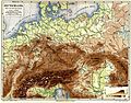
 Deutsche Militärkarte Schweiz-Norditalien.png 5,000 × 5,000; 52.73 MB
-

-

-
 Karte des Lagers Esterwegen 1955.jpg 1,249 × 1,090; 1.98 MB
-

-
 Lange diercke sachsen deutschland bodenverhaeltnisse 1.jpg 2,512 × 3,472; 7.96 MB
-
 Lange diercke sachsen deutschland bodenverhaeltnisse 2.jpg 2,512 × 3,488; 8.78 MB
-
 Lange diercke sachsen deutschland bodenverhaeltnisse 3.jpg 2,552 × 3,496; 8.69 MB
-
 Lange diercke sachsen deutschland bodenverhaeltnisse.jpg 5,320 × 3,326; 20.46 MB
-
 Map of pre World War II Germany TK25 Cloppenburg 3114 Cloppenburg City.jpg 1,843 × 1,611; 1.46 MB
-
 Map of pre World War II Germany TK25 Cloppenburg 3114.jpg 10,328 × 7,963; 22.34 MB
-
 Meilenblätter-sachsens-berliner-exemplar-georeferenziert.jpg 2,727 × 1,917; 822 KB
-
 Meyers b4 s0801a.jpg 2,048 × 1,601; 874 KB
-
 PSM V52 D061 Physical geography of germany.png 1,888 × 1,973; 670 KB
-
 Rappenau-topo1902.jpg 1,523 × 1,083; 927 KB
-
 TK 25000 1951 Ostende Langeoog 2211.jpg 10,312 × 7,955; 14.71 MB
-
 TK 25000 1955 Baltrum 2210 (Ausschnitt).jpg 4,062 × 2,533; 2.7 MB
-
 TK 25000 1955 Baltrum 2210.jpg 9,400 × 7,727; 7.61 MB
-
 TK 25000 1955 Burlage 2911.jpg 9,312 × 7,536; 12.96 MB
-
 TK 25000 Langeoog 1955 1951.jpg 7,999 × 3,611; 11.91 MB
-
 TK25 Germany 1952 Schlepzig 3949 Third Edition-AMS.jpg 11,536 × 8,738; 14.86 MB
-

-

-

-

-

-
 Physikalisch-statistischer Atlas des Deutschen Reichs 1878 (131438034).jpg 12,061 × 9,468; 52.7 MB
-


.jpg)
.jpg)


.jpg)
.jpg)


.jpg)


.jpg)


.jpg)
.jpg)