Category:Old submaps of Paris 7e arrondissement
Jump to navigation
Jump to search
Media in category "Old submaps of Paris 7e arrondissement"
The following 20 files are in this category, out of 20 total.
-
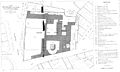 Abbaye-aux-Bois - Plan.jpg 5,864 × 3,507; 1.89 MB
-

-

-
 Couvent des Carmélites sur plan Bretez de 1739.png 360 × 349; 293 KB
-
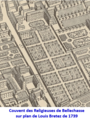 Couvent des Dames de Bellechasse sur plan Louis Bretez de 1739.png 345 × 457; 361 KB
-
 Couvent Sainte-Valère.png 489 × 326; 404 KB
-
 Demande de la Société orientale de France à Guizot 1847.jpg 1,433 × 928; 305 KB
-

-
 Gravure plan Petites Maisons c.1785.png 1,664 × 1,220; 3.71 MB
-
 Hospice des Ménages, D.4454.jpg 4,134 × 2,995; 1.48 MB
-
 Hospital des Petits Maisons, Paris; plans. Engraving. Wellcome V0014695.jpg 3,071 × 2,315; 3.72 MB
-
 Isle Maquerelle ou des Cignes.jpg 1,356 × 936; 1.53 MB
-
 Les anciens hôtels de la rive gauche (1880).jpg 2,343 × 3,198; 1.5 MB
-

-
 Plan De l'Hopital Des Petites Maisons. Paris Musées 20230611205042.jpg 6,824 × 5,232; 28.14 MB
-
 Plan De l'Hopital Des Petites Maisons. Paris Musées 20230611205158.jpg 7,272 × 5,472; 30.23 MB
-
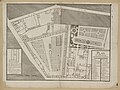
 Plan de l'Hôpital des Petites Maisons - Buron, del. ; Hérisset sculp. - btv1b84445197.jpg 8,400 × 6,213; 9.62 MB
-
 Plan of the Hotel d'Amelot by Germain Boffrand, Paris 1712.jpg 400 × 469; 74 KB
-
 Projet pour le quartier de Gros Caillou en 1814.png 654 × 269; 411 KB
-
 Turgot 1739 map MEP detail.jpg 1,136 × 917; 677 KB

.jpg)
_Partie_N%C2%B0._1._Croquis_du_plan_au_1(er)_janvier_1877._du_Minist%C3%A8re_d,_D.8021(431)(2).jpg)


_Dominique,_6(e)_Partie_N%C2%B0._1._Croquis_du_plan_au_1(er)_janvier_1877._du_Minist,_D.8021(454)(2).jpg)


.jpg)
._18_dessins_et_plans._Feuille_1(re)_Hospice_des_M%C3%A9nages._1846._D.8021(824)(2).jpg)


