Category:Old street maps of Paris
Jump to navigation
Jump to search
Subcategories
This category has the following 2 subcategories, out of 2 total.
L
- Le Paris de Guillot (7 F)
Media in category "Old street maps of Paris"
The following 16 files are in this category, out of 16 total.
-
 Plan routier de la ville de Paris, divisé en douze arrondissemens, 1828 - Stanford Libraries.jpg 9,450 × 6,595; 12.02 MB
-
 Plan routier de la ville de Paris, divisé en douze arrondissemens, 1828 - Stanford Libraries.tif 9,450 × 6,595; 59.46 MB
-
 Nouveau Plan de Paris en relief... 1840 - Gallica.jpg 8,388 × 6,766; 8.22 MB
-

-
 Atlas des anciens plans de Paris - Paris de 1285 à 1314 - David Rumsey.jpg 9,930 × 12,670; 78.27 MB
-
 Auguste Logerot, Nouveau plan itinéraire de la ville de Paris, 1841 - e-rara.jpg 6,630 × 4,760; 36.91 MB
-
 Direction générale de l'aménagement urbain, Plan de Paris - Paris Musées.jpg 7,352 × 5,088; 25.01 MB
-
 Georg Bauerkeller, Nouveau Plan de Paris en relief, 1839 - David Rumsey.jpg 11,678 × 9,366; 32.93 MB
-
 Nouveau plan de Paris en relief, 1845 - Paris Musées.jpg 8,040 × 6,392; 37.46 MB
-
 Nouveau plan itinéraire de la ville de Paris... 1836 - Norman B. Leventhal Map Center.jpg 6,840 × 4,642; 8.34 MB
-
 Nouveau plan itinéraire de la ville de Paris... 1837 - Norman B. Leventhal Map Center.jpg 6,798 × 4,702; 8.05 MB
-
 Nouveau plan itinéraire de Paris by Alexandre, 1845 - National Library of Sweden.jpg 3,668 × 2,840; 4.77 MB
-
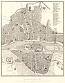
 Plan de la ville de Paris nouvellement dressé - Norman B. Leventhal Map Center.jpg 6,600 × 4,990; 7.73 MB
-
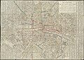
 Plan de la ville de Paris, divisé en 12 arrondissemens, et 48 quartiers, 1823 - Stanford Libraries.jpg 16,282 × 10,215; 34.47 MB
-
 Plan de Paris, avec indication des rues nouvelles et des travaux en cours d'exécution.jpg 4,261 × 2,975; 8.46 MB
-
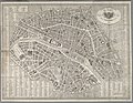
 Plan routier de la ville de Paris et de ses faubourgs.jpg 10,000 × 7,056; 39.68 MB


