Category:Old maps showing the history of the former colonies of France
Jump to navigation
Jump to search

Media in category "Old maps showing the history of the former colonies of France"
The following 29 files are in this category, out of 29 total.
-

-
 1850 Levasseur Map of Ile de La Reunion - Geographicus - Reunion-levasseur-1850.jpg 4,000 × 2,828; 2.83 MB
-

-
 Domaine colonial de la France et ses productions. Tableau - dressé par J. Forest... - btv1b530636240.jpg 15,534 × 12,067; 27.57 MB
-
 319 of 'Cours normal d'histoire de France, etc' (11058832225).jpg 2,771 × 2,206; 1.47 MB
-

-

-
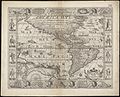
 Americae (8430919308).jpg 800 × 689; 153 KB
-
 Americae nova descriptio (8343559408).jpg 800 × 648; 164 KB
-
 Americae nova tabula (8343848740).jpg 800 × 656; 150 KB
-
 Carte AEF.jpg 10,083 × 15,000; 22.37 MB
-
 Carte AOF Paul Morand Paris-Tombouctou.jpg 3,849 × 3,015; 2.5 MB
-
 Chandernagor et Bengale 1930.jpg 1,459 × 1,095; 536 KB
-
 Collectible card Comptoirs des Indes.jpg 648 × 411; 80 KB
-
 Colonies française d'Océanie, 1938.jpg 1,111 × 640; 656 KB
-
 Comptoirs 1885.jpg 516 × 595; 165 KB
-
 Domaine colonial de la France et ses productions - dressé par J. Forest... - btv1b53065328b.jpg 15,427 × 12,226; 27.39 MB
-
 Eboue wwII prop 03-0118a.jpg 1,200 × 1,155; 350 KB
-
 France & Colonies-1894-mappemonde des colonies.jpg 4,373 × 2,998; 2.84 MB
-
 France 1938, 28.jpg 5,503 × 2,648; 1.65 MB
-
 French capture of Goree over the Dutch in 1677.jpg 1,357 × 1,030; 275 KB
-

-

-
 Meyers b9 s0954a.jpg 1,589 × 2,048; 504 KB
-
 Nos possessions des cinq parties du Monde, 1939.jpg 1,727 × 1,230; 546 KB
-
 Nouveau Planisphere Officiel L'Empire Colonial Francais et les Possessions Colonales des Nations.jpg 13,864 × 19,934; 70.05 MB
-
 Ordonnance de mars 1685 esclaves Amériques, territoires d'application.png 1,200 × 1,000; 1.45 MB
-
 Plan de la colonie francaise de la calle 1788.jpg 8,896 × 6,652; 8.05 MB
-
 The graphic map of European possessions in Africa (2710779978).jpg 1,491 × 2,000; 2.69 MB


.jpg)
.jpg)
.jpg)
.jpg)
.jpg)
.jpg)


.jpg)


.jpg)
.jpg)